All About Water
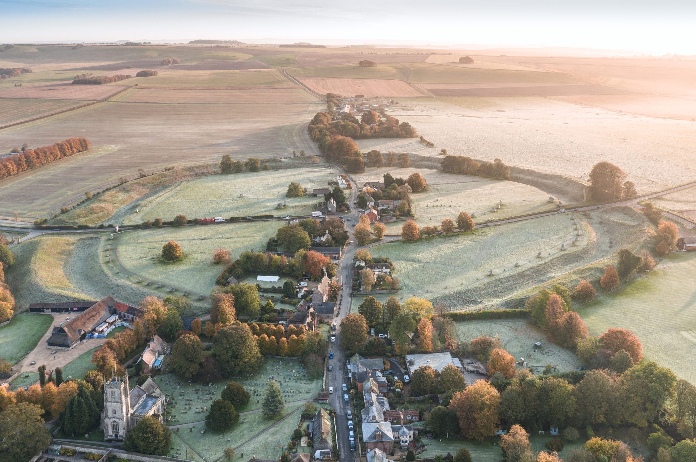
Avebury and the River Kennet

Chatting with visitors to Avebury’s stone circle over the years I’ve heard a lot of different assertions about the site and its mysterious ‘energies’. The henge is a ‘convergence place’, where two great ley lines (associated with the Saints Mary and Michael) meet, representing the ‘coming together of male and female principles’. One resplendently bearded wizard once told me the henge had been constructed as a landing place for extra-terrestrials – a theory for which the profusion of corn circles that have appeared in the surrounding acres was cited as evidence.
None of these devotees, however, mentioned the elegantly simple explanation for Avebury’s existence proposed by a hydrologist I met in a café in Marlborough once: that they (the Neolithic people who built the stone circle) believed it marked the source of the Thames.
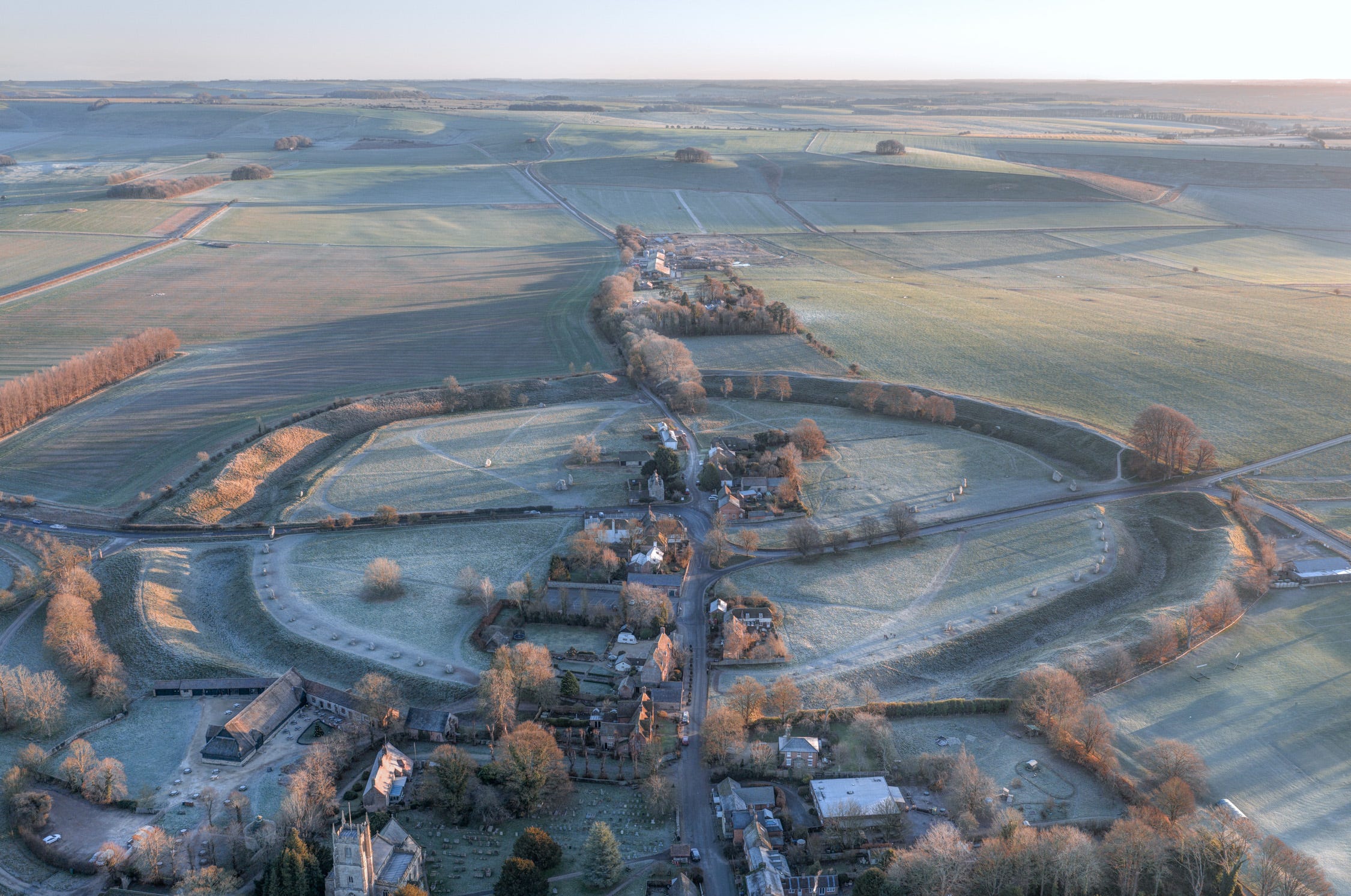
One look at a river map of Britain and you can see why he thought this. The Kennet, which sweeps around Avebury before flowing through the North Wessex Downs, is a major tributary of the Thames, which it meets at Reading. Some 5,800 years ago, when most of southern England was covered in primal forest, pioneer Neolithic herder-farmers from the Continent must have followed the rivers westwards to explore the Chalklands. A century or two after their first landfall in the southeast, we have evidence they found and settled in the saucer-shaped plateau at the head of the Kennet, where, a millennium later, the mighty henge would be constructed.
Fed by numerous springs, this sheltered Shangri La of rich, fertile, alluvial soil, surrounded by low hills, forms the westernmost extremity of the Thames catchment. The basin is a rare triple watershed: from the ridges enfolding it, the streams flow south into the English Channel, east into the North Sea and west into the Irish Sea, enabling people to reach it from an exceptionally wide area. This, along with the abundance of flint for tool making and timber for building houses, to say nothing of the gin-clear drinking water bubbling from the ground on all sides, would have held great allure for subsistence farmers.
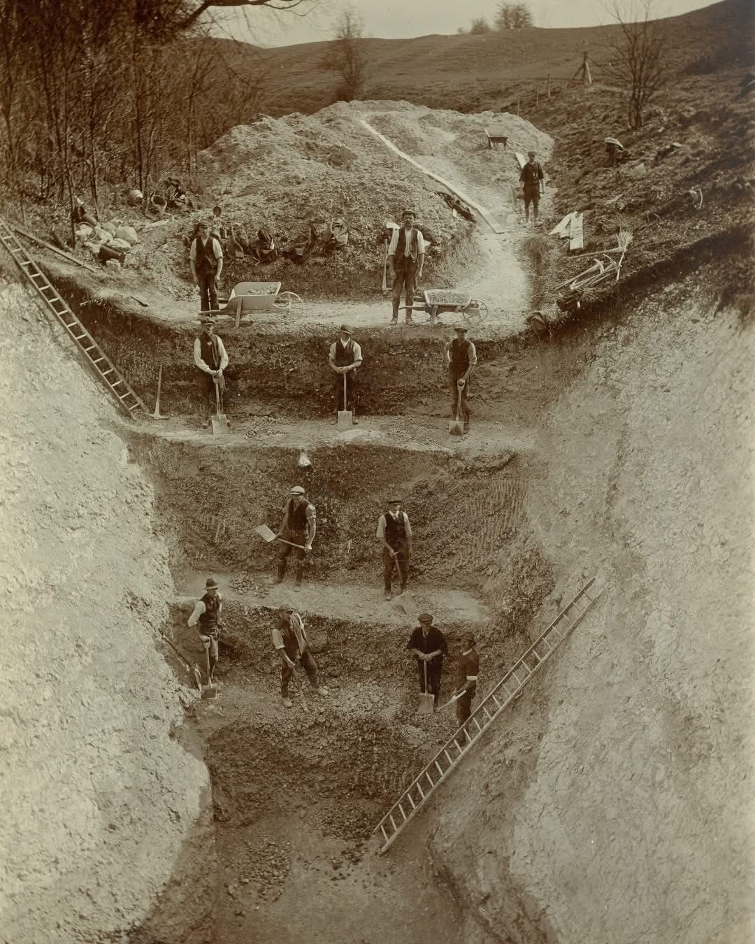
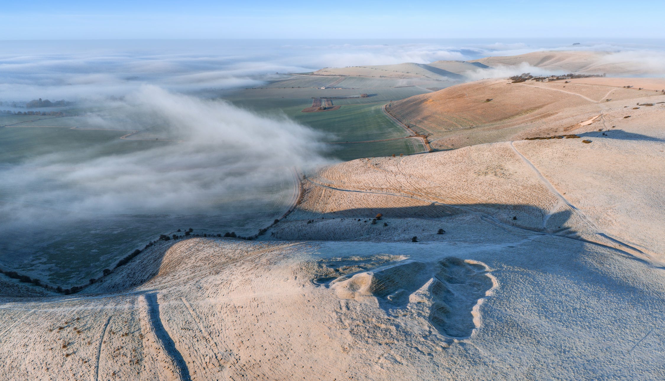
Thanks to the archaeological attention lavished on the area in the 20th century, we have a clear chronology for the many elements that make up Avebury’s wider ceremonial ceremonial landscape. And they were all connected in some way to the river. The two branches of the Kennet, which rise on the Downs to the north, flow around a hill that’s so low it barely warrants the name. Yet, presumably because it remained dry throughout the winter, Windmill Hill has yielded some of the earliest evidence of settlement and ceremonial earthworks in the area, in the form of a causewayed enclosure dated to the late 37th century BC.
People would have gathered here, at auspicious times of year such as the summer or winter solstices, to perform rituals, feast, exchange gifts and barter livestock. Some of the oldest pottery ever discovered in Britain was unearthed in its ditches, presumably buried as offerings. A rectangular enclosuree dug around the same time is thought to have served as a mortuary site, where corpses were laid out to be picked clean by carrion birds before the bones were interred in one of the many chambered tombs adorning the surrounding slopes (West Kennet being the most famous of these).
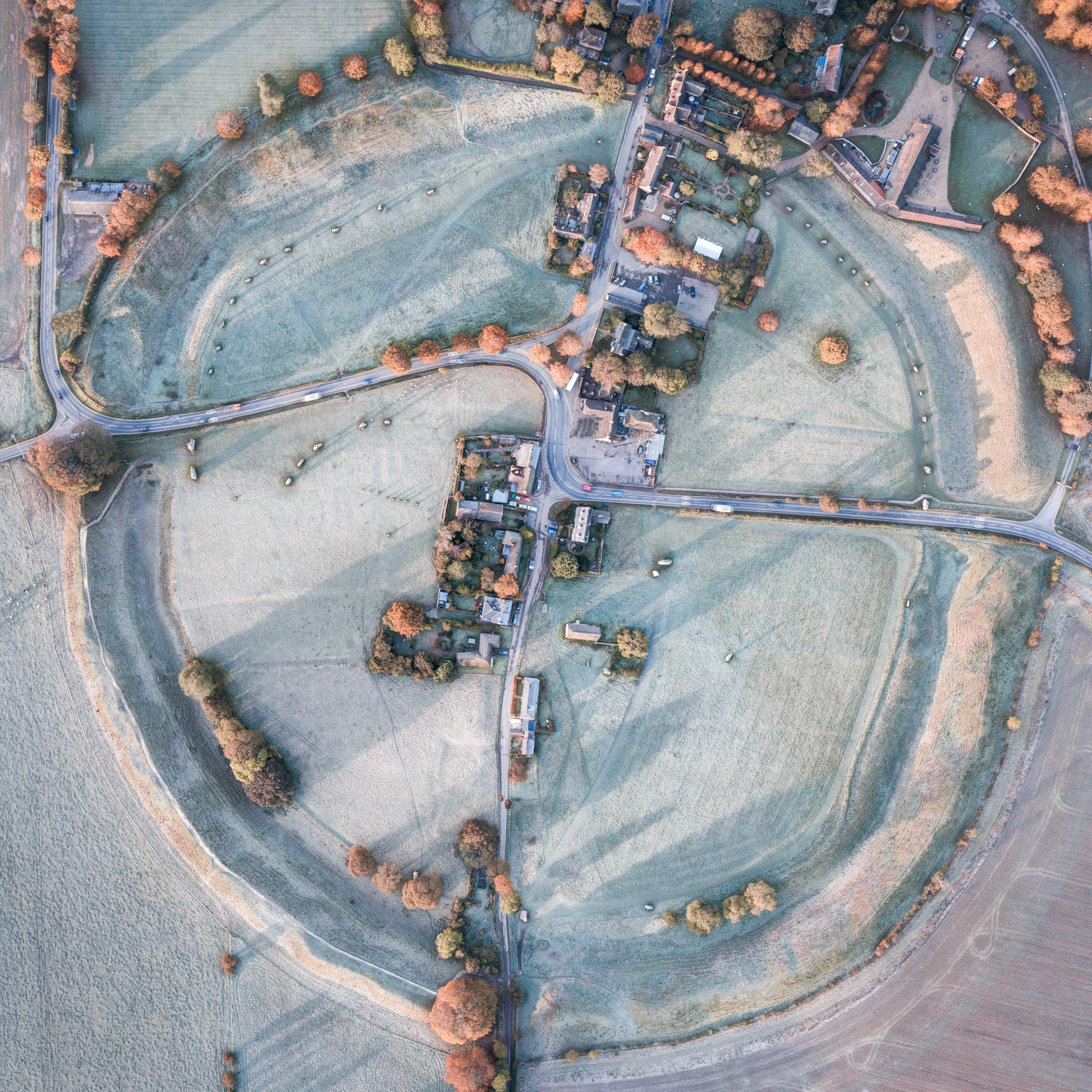
It is my belief the location was significant because of its proximity to the twin sources of the Kennet, whose streams flowed around the flanks of Windmill Hill. The spot where they converge, a mile to the south, is literally just a stone’s throw away from the great henge. This cannot be coincidental. It may also have been the case that the extraordinary depth of the Avebury circle’s ditches was because their excavators wished to reach the water table. This is a controversial claim, much debated by archaeologists, but it is possible that at certain times of year, following periods of protracted rainfall, the stone circle would have been surrounded by a moat.
Did our distant ancestors believe the River Kennet was sacred – a Neolithic equivalent of the Ganges or Godavri Rivers in India? Throughout prehistory, springs, sources and confluences were often the locations of funerary sites, perhaps because the flow of water across the land was construed as a metaphor for birth, life and, with the arrival of the river at the ocean, the eternal afterlife.
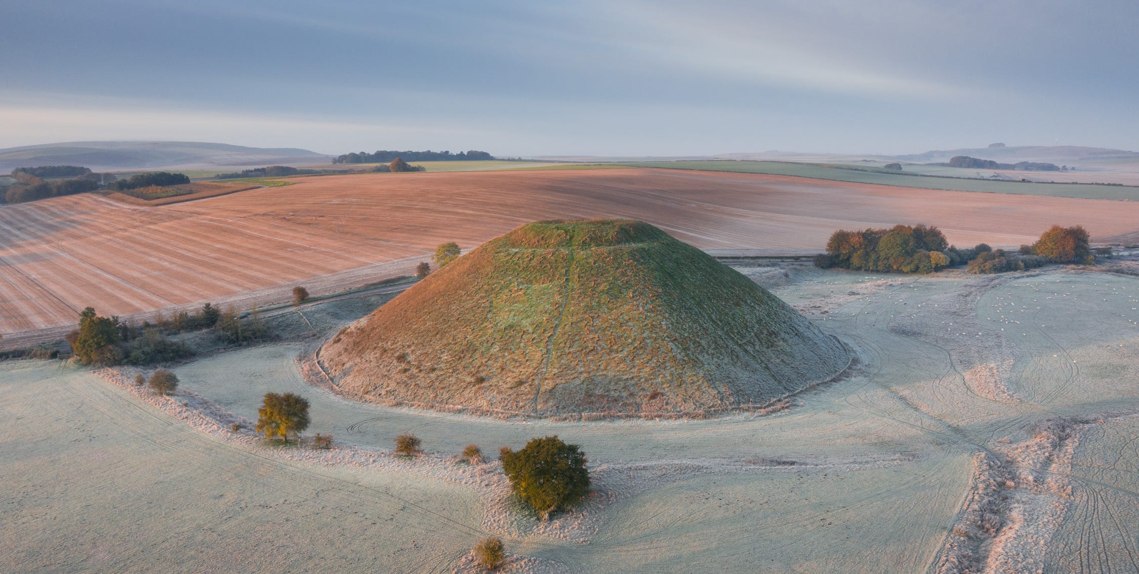
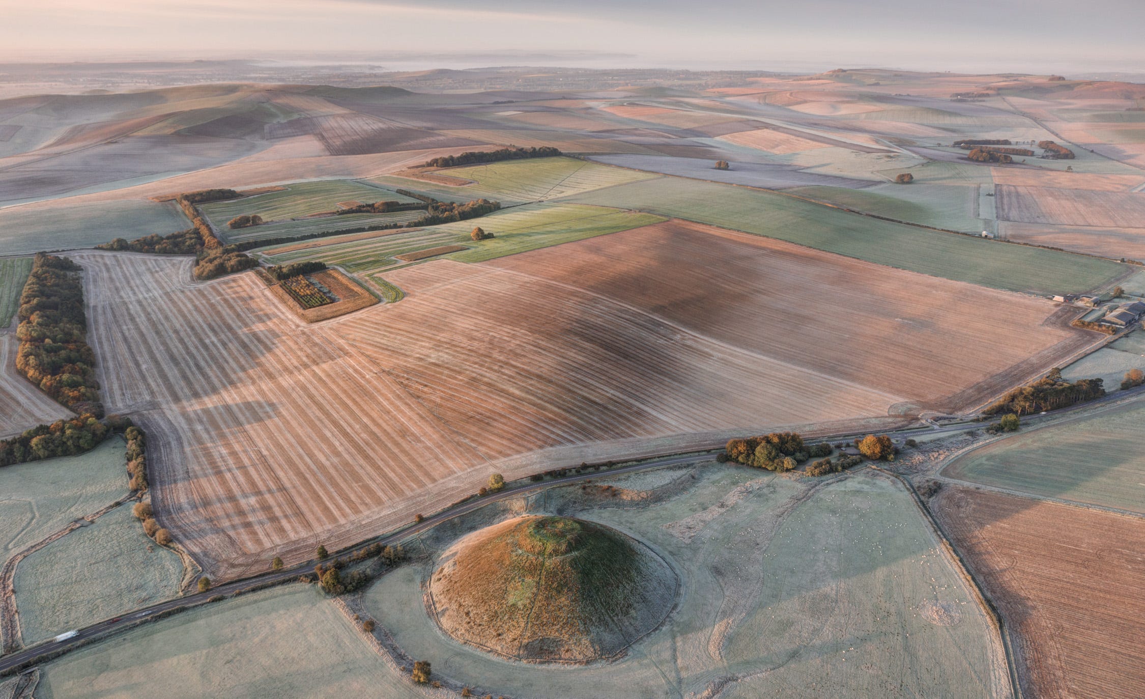
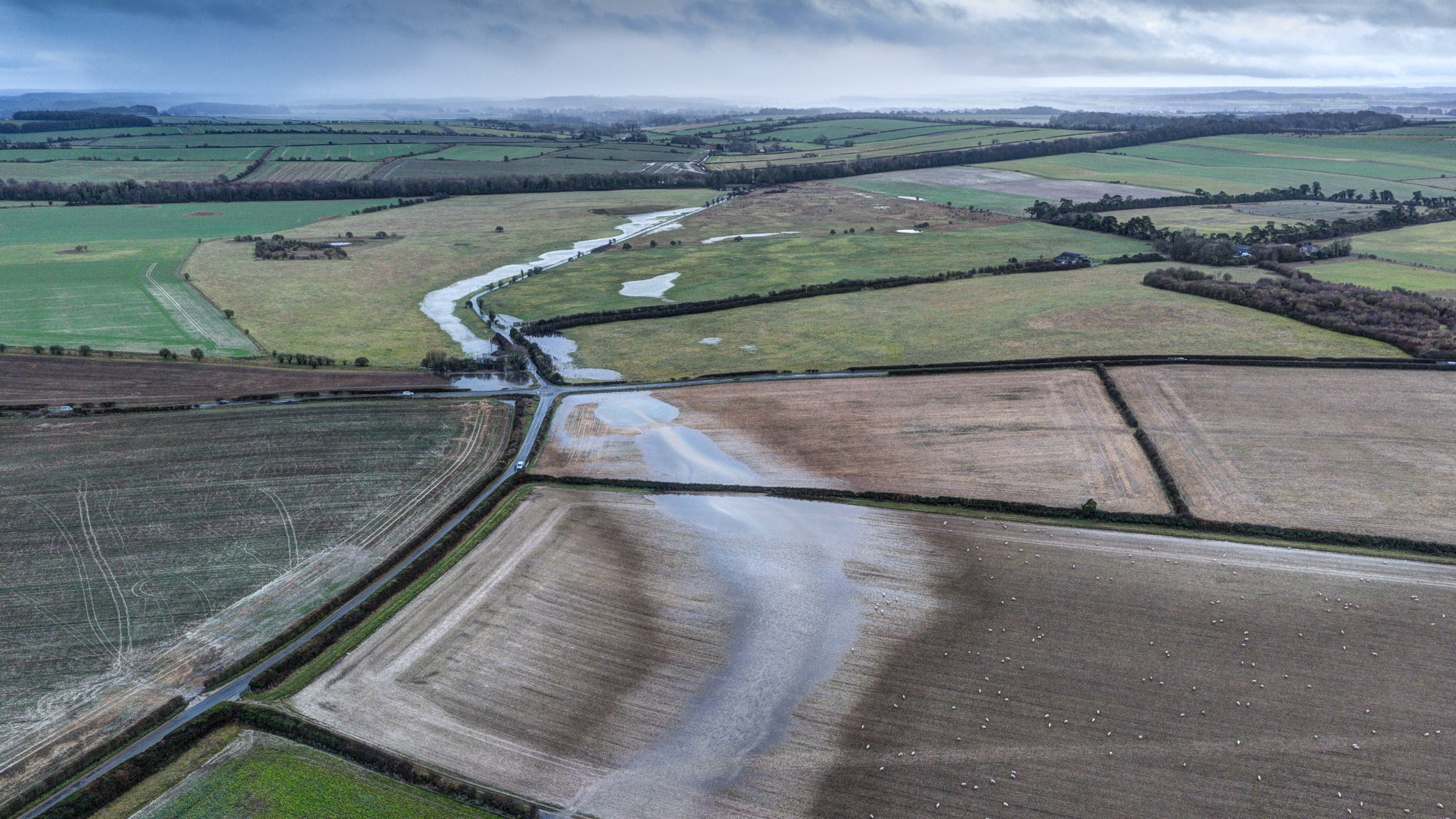
We can never know whether this was the case, but whatever stories they told or beliefs they held, it is clear that our Neolithic ancestors revered rivers. Among the most dramatic proof of this is Silbury Hill, the giant mound erected at the end of the period, around 2,400BC. We know from the remains of a causeway on its northern side that the mound originally rose from a small lake, hollowed out when the builders, over successive decades, dug spoil to enlarge it.
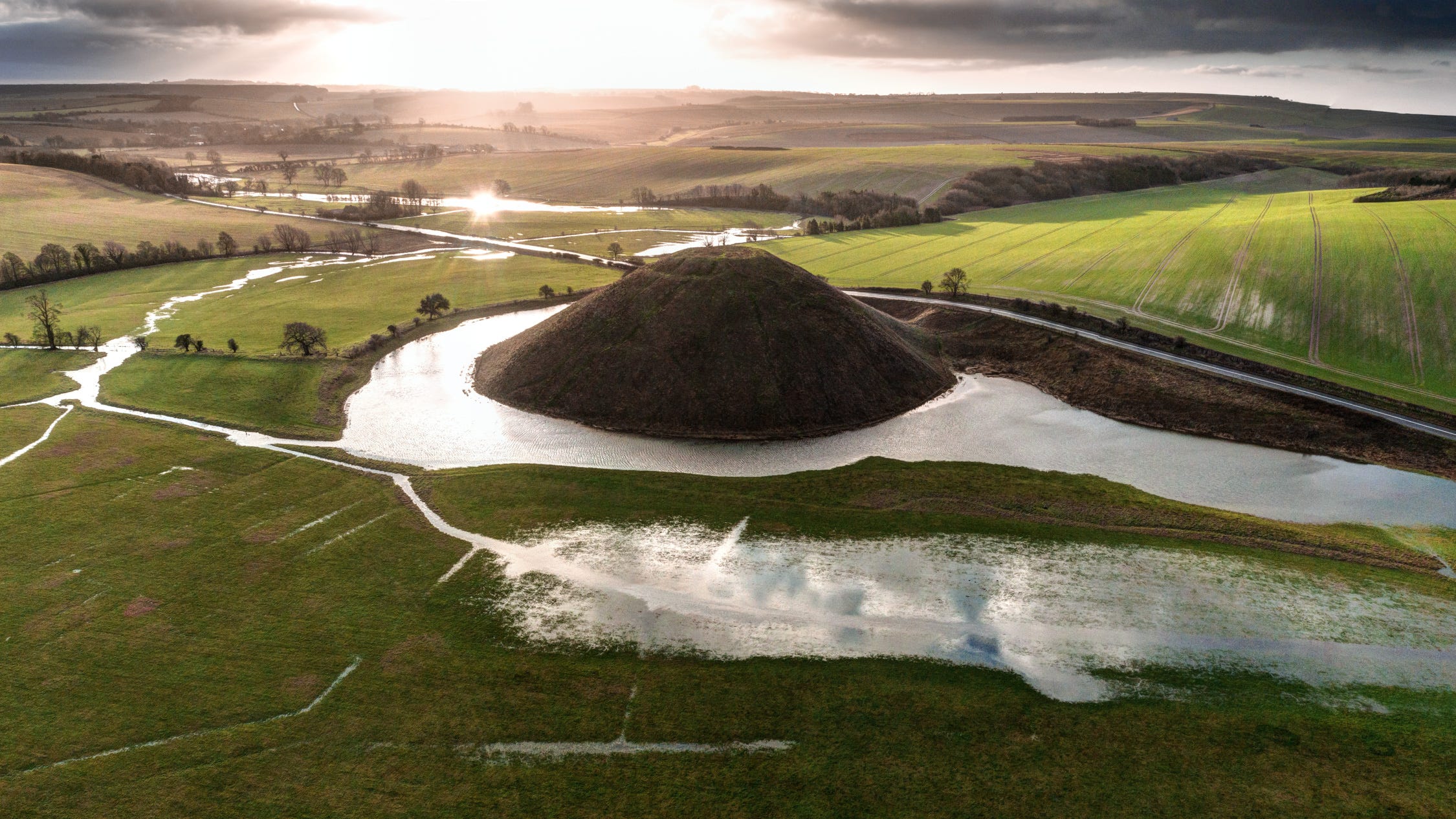
This photograph, taken during flood conditions when water levels were comparable to what they would have been at the time Silbury was built, shows the prominence of water in the landscape. Silver tendrils enlace the monument, forming beautifully reflective pools in the adjacent pasture, where the sky appears on the water-logged ground – an exquisite example of liminality.
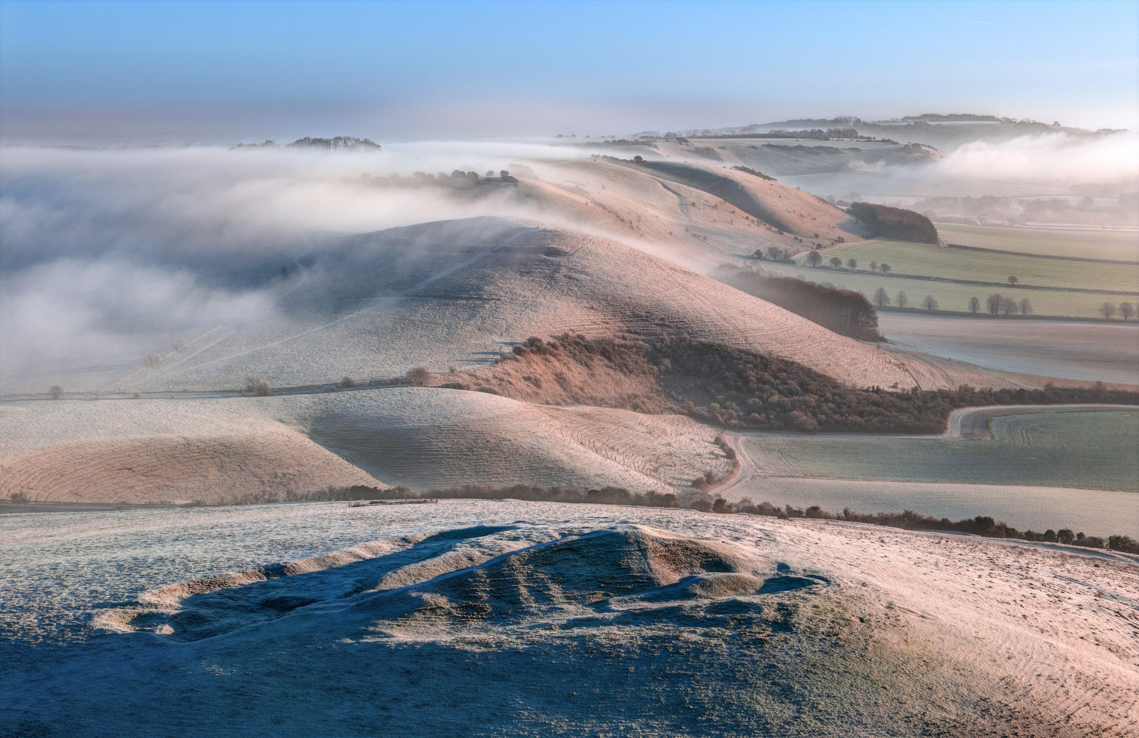
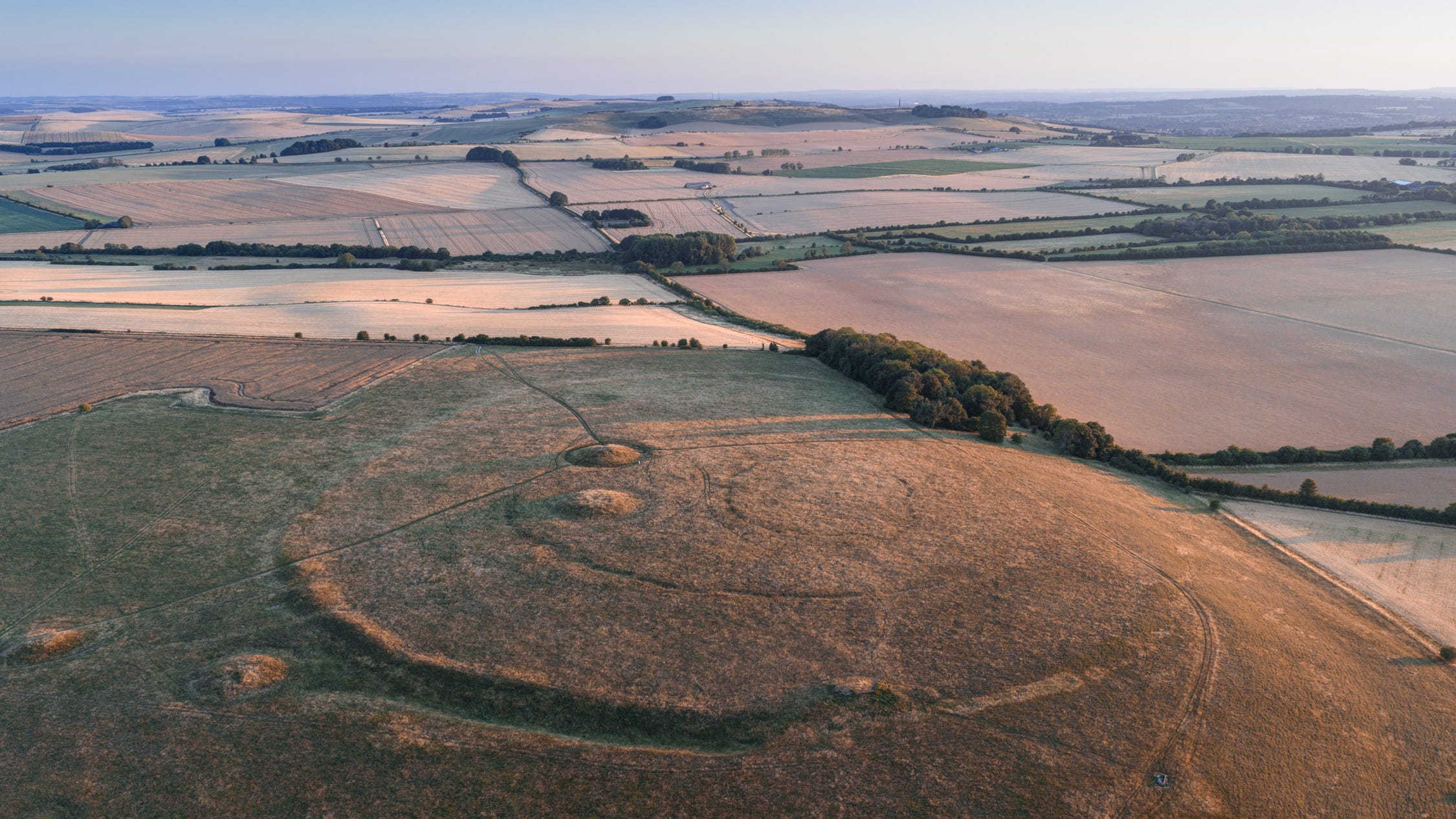
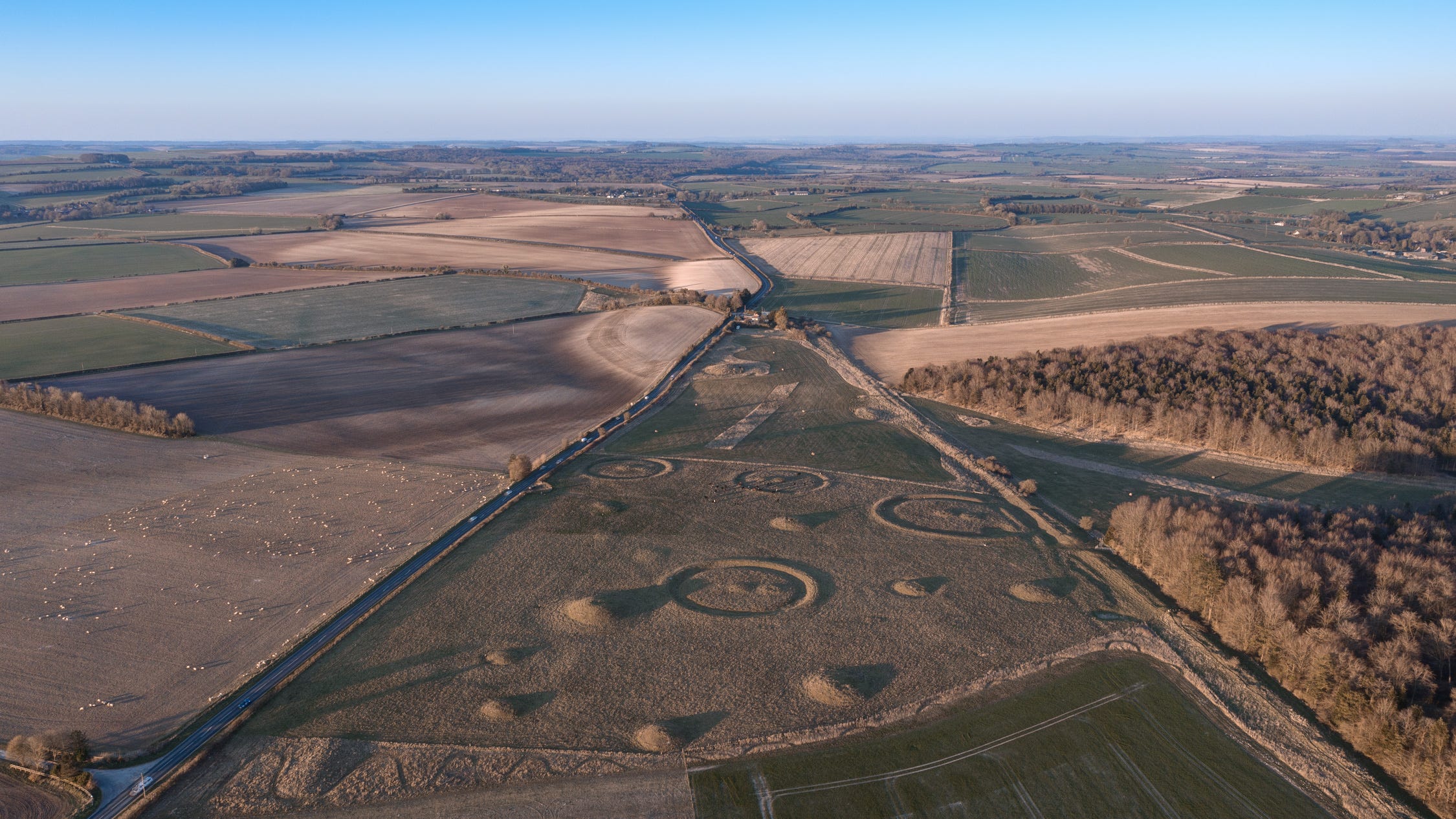
On the ridges overlooking the basin to the south are to be found other wonderful monuments, the most striking of them contemporary with Windmill Hill. The causewayed enclosure on Knap Hill, an important funerary site in the 37th century BC, sits on the opposite side of a pass from Adam’s Grave, a spectacular, trapezoidal chambered tomb. It was, incidentally, across this same pass the great sarsen stones used to make the Stonehenge trilithons must have been dragged on their journey from the North Wessex Downs to Salisbury Plain.
This elevated site, clearly of great significance in the early Neolithic period, also overlooks the source of the Wiltshire Avon, which rises at a cluster of springs in Pewsey Vale below. The River Avon flows between Durrington and the spot marked by a bluestone henge where worshippers are believed to have begun their ceremonial procession to the great circle at Stonehenge.
Attitudes to water generally, and rivers in particular, have changed as much as the landscape since Neolithic times. In Britain, we treat them as sewers. People are often oblivious to their course, or even existence. But thousands of years ago, they were the essence of life itself. Re-uniting the wondrous monuments left by our ancestors to the rivers with which they were associated helps us appreciate their deeper significance. It has become commonplace to talk about rekindling our connectedness to the land, but the rivers that nourish the soil and whose flows have, over thousands of years, carved the very valleys we inhabit are of no less importance.
Winterbournes
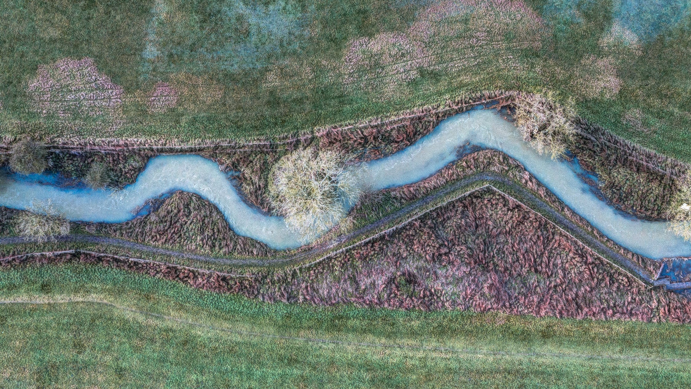
By way of a coda: I recently received an urgent message from farmer-archaeologist, Martin Green, whose land encompasses an important stretch of the great Dorset Cursus. On our previous meeting, when I’d been photographing crop marks of the earthwork in high summer, we discussed the significance of the mysterious ‘winterbournes’ that appear and disappear at three places along the Cursus. Forming the headwaters of three rivers, these emerge from the ground in shallow, dry combes when the water table rises after periods of heavy rain. As I write, we are experiencing one such period and Martin, who is applying for a grant to convert some of his land to an environmentally friendly marsh, asked if I’d rush down to photograph the winterbourne that had just appeared on his farm at Wyke Down.
Light and weather conditions were challenging - the lanes had in places literally become rivers - but during a very brief pause in the downpour I managed to get a shot or two. They convey what a dramatic spectacle winterbournes create - something I’d never fully appreciated.
For generations, such streams only appeared once every ten or twenty years. But for the past five, due to increased rainfall across much of southern England, they have been an annual phenomena. Back in the Neolithic, when water tables were higher, they were probably more common. Their existence goes some way to explaining why people in the Middle Neolithic, around 3,400-3,300 BC, went to the trouble of digging a two-metre-deep ditch for 10km (6.3 miles) across this stretch of Cranborne Chase. The Cursus traversed the birthplace of the rivers on which their settlements, further south on the greensand region of coastal Dorset, depended.
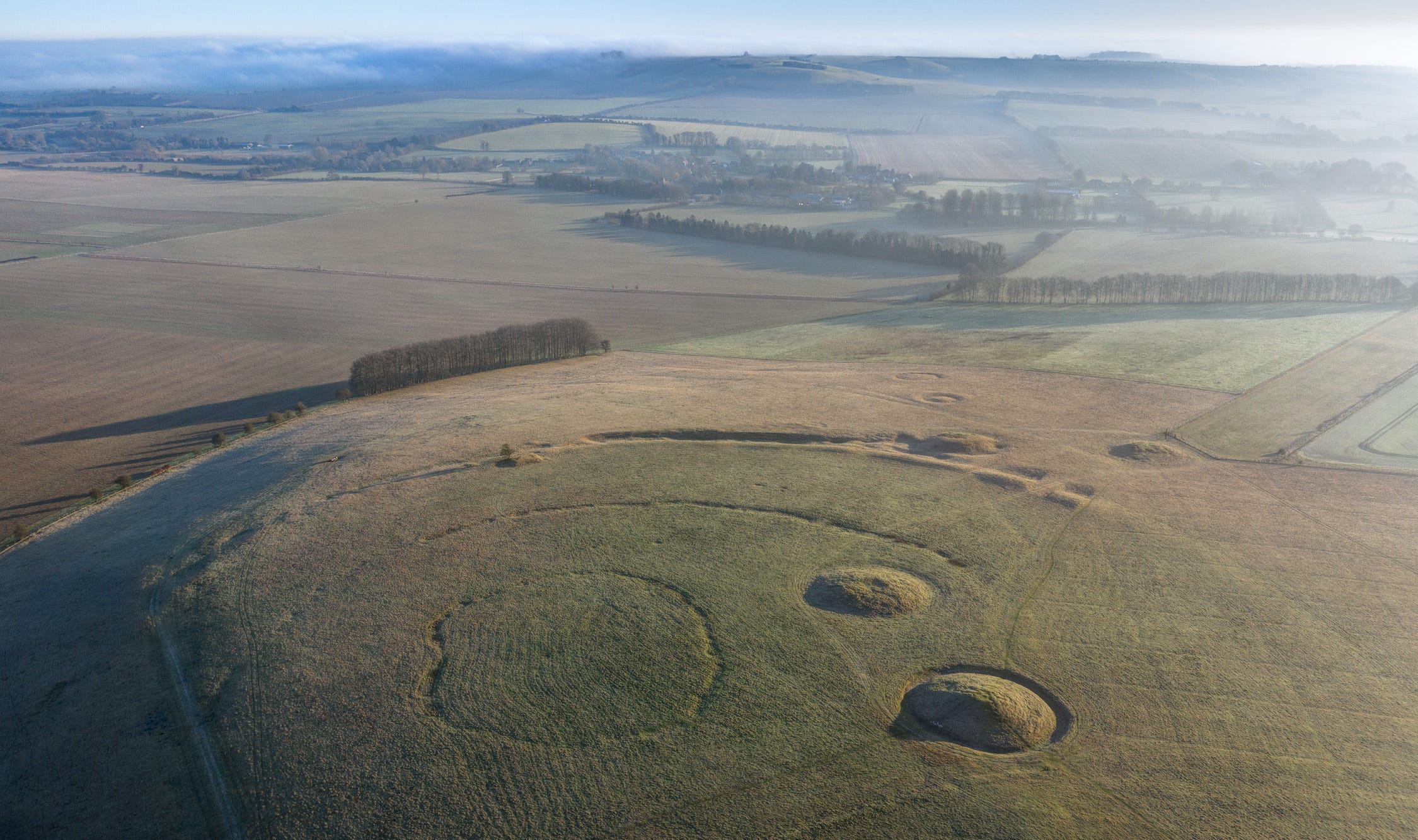
Here’s one of the photos I took yesterday, showing the exact place where the winterbourne currently feeding the River Allen crosses the (invisible) Dorset Cursus. The trees and little pond to the top left are the site of two pit henges and a small Neolithic settlement.
To conclude, an aerial photograph the nearby Early Bronze Age cemetery at Oakley Down, which was originally located on ground overlooking a winterbourne (whose course you can make out starting at the dark soil to the left of the image and passing through what is now a gap in the coppice to the right). Modern agricultural drainage has meant it no longer appears, but with the above image in mind it is possible to picture how the water course might have looked 4,000 years ago, flowing alluringly past the dramatic cluster of mounds.
Thanks
Thank you for reading to the end of my post! If you enjoyed it, please do give me a like, drop me a line, and, best of all, share with any friends or family members you think might be interested.
In case you weren’t aware, I’m on Instagram @davidrabram. And I have book out featuring a collection of my prehistory photographs called the ‘Aerial Atlas of Ancient Britain’, signed copies of which may be purchased via this link.
I never knew what a winterbourne was before! Fascinating. Lovely photos and a thought provoking piece.
It’s mentioned in the comments but I was struck by the proximity of the river Chew at Stanton Drew and the ruined avenues that lead towards it. I wish I had the words to describe how it felt!