

In Search of the Sacred
New discoveries on Exmoor and Purbeck

Promoting my book around the Shires of England and Wales this past year, I often found myself encouraging audiences to consider why the locations of their favourite barrows may have been selected by our Bronze Age or Neolithic ancestors. What qualities or features in the landscape made the place special? And what the answers might reveal about the mindset of a monument’s builders?
In the cases of the sites featured in this post, the raw appeal of each remains obvious, despite the fact they all possess very different atmospheres and rest within terrain much altered since the barrows were created around 4,000 years ago.
These grave sites are all on high, exposed, prominent landforms offering extensive views over land and sea. They stand out from their surroundings and would have formed reference points for, and exerted a gravitational pull on, the herders whose animals grazed the areas, especially once the great earth or stone mounds had been erected.
Could it be that the names and deeds of their occupants would have been widely known, passed on to successive generations through folk tales, creation myths, sagas and stories woven around the local topography?
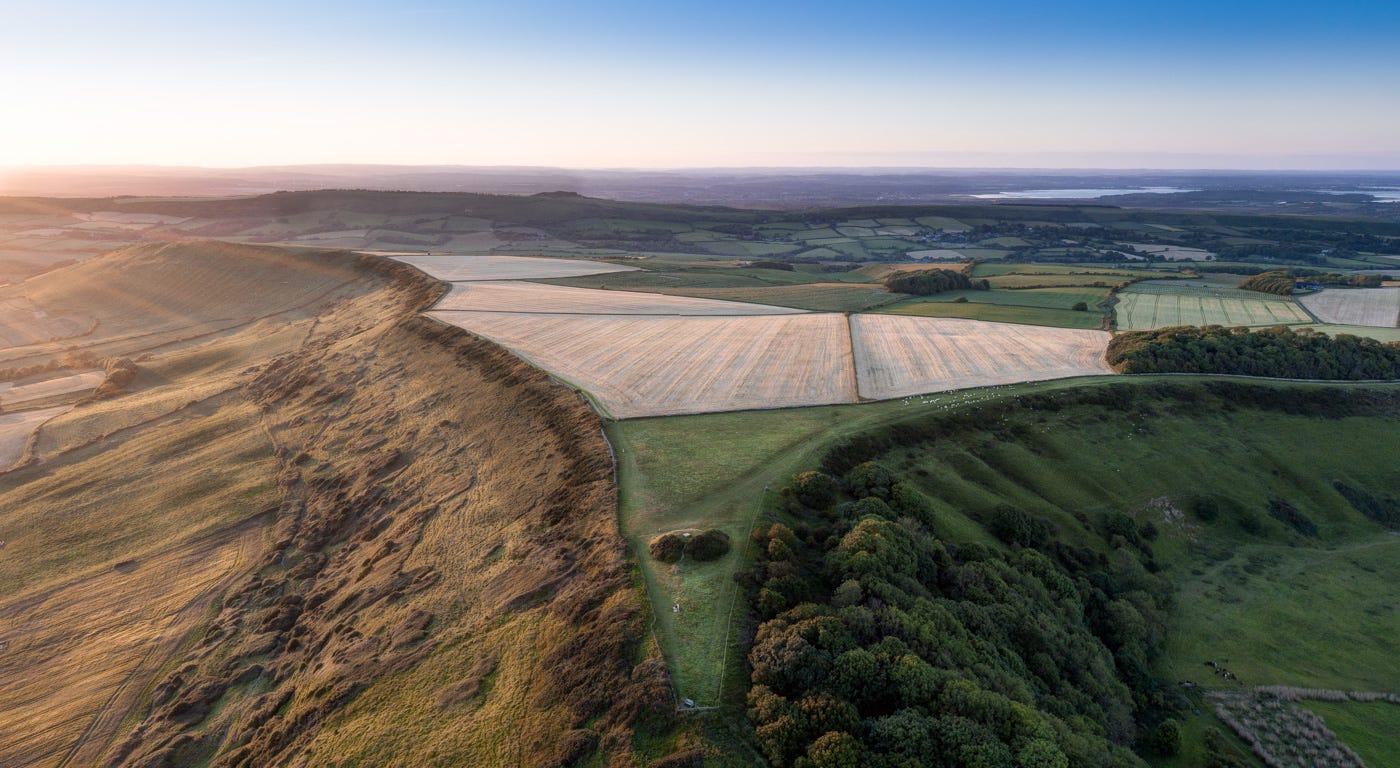
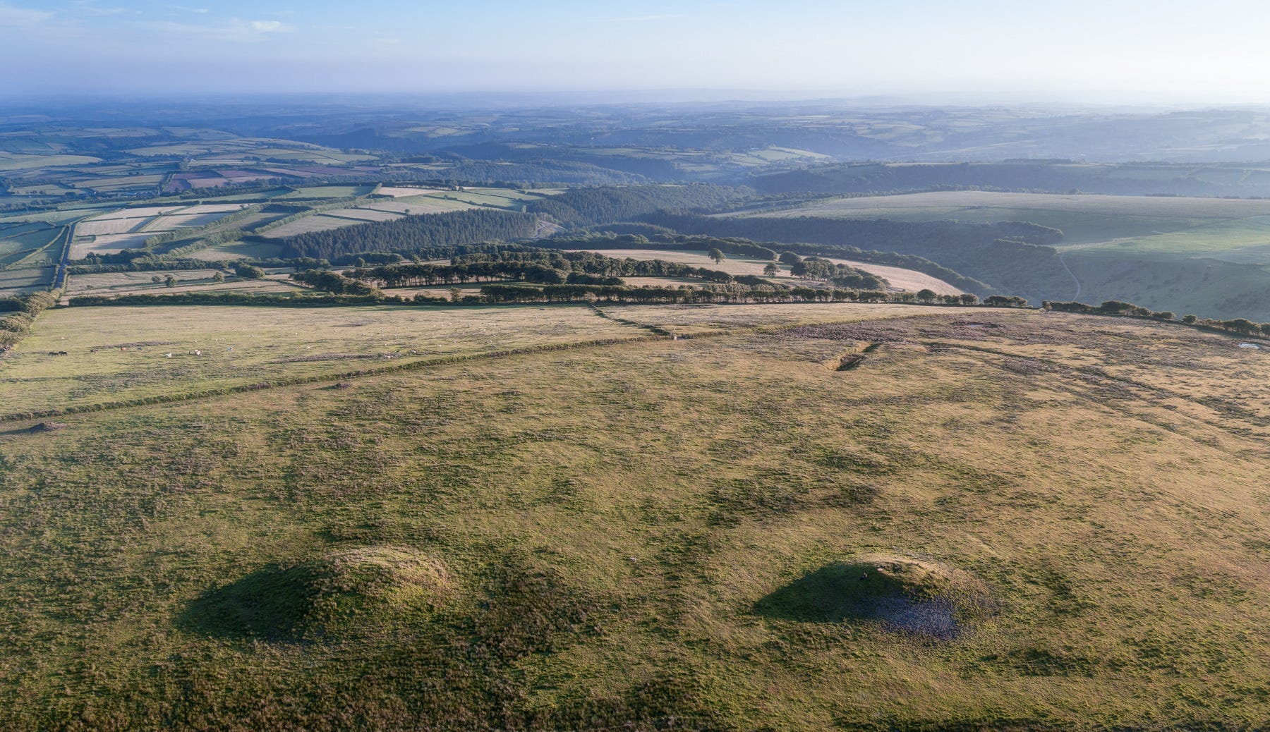
Setta Barrow, Exmoor
Archaeological dispersal maps for particular types of daggers, pots and other artifacts suggest that goods travelled over considerable distances, between Cornwall and the Lake District, Northumberland and Avebury, for example. But did the names of barrows and those buried inside them also diffuse along the same arteries?
As someone who has walked and camped with nomadic-pastoralist people in different parts of the world, and listened to their explanations for how hills, rivers and ritual sites came into being, it inconceivable to me that this would not have been the case. In pre-literate societies, people carry mnemonic maps in their heads - often in the form of sequences of places recited and remembered in chants or verses - to aid movement across unfamiliar terrain. It’s tempting to think similar stories travelled across these islands in the Bronze Age, if not long before.
Linear Bronze Age cemetery, Beacon Batch, Mendip Hills - beside a track surfaced in WWII, over a path with flint scatters showing Mesolithic use
These wondrous places are among the few surviving, tangible reminders of the cultures that existed on these islands before the arrival of the Romans and Saxons. Yet their value lies not just in their antiquity: funerary cairns and earthen barrows also reveal to us, in the present day, the significance of places in the landscape - spots with the power to raise the spirits, restore our sense of perspective and balance, and remind us, as they would have thousands of years ago, that we are merely the latest in a long line of custodians to have inhabited these high moors and limestone promontories. That ‘all this too shall pass’.
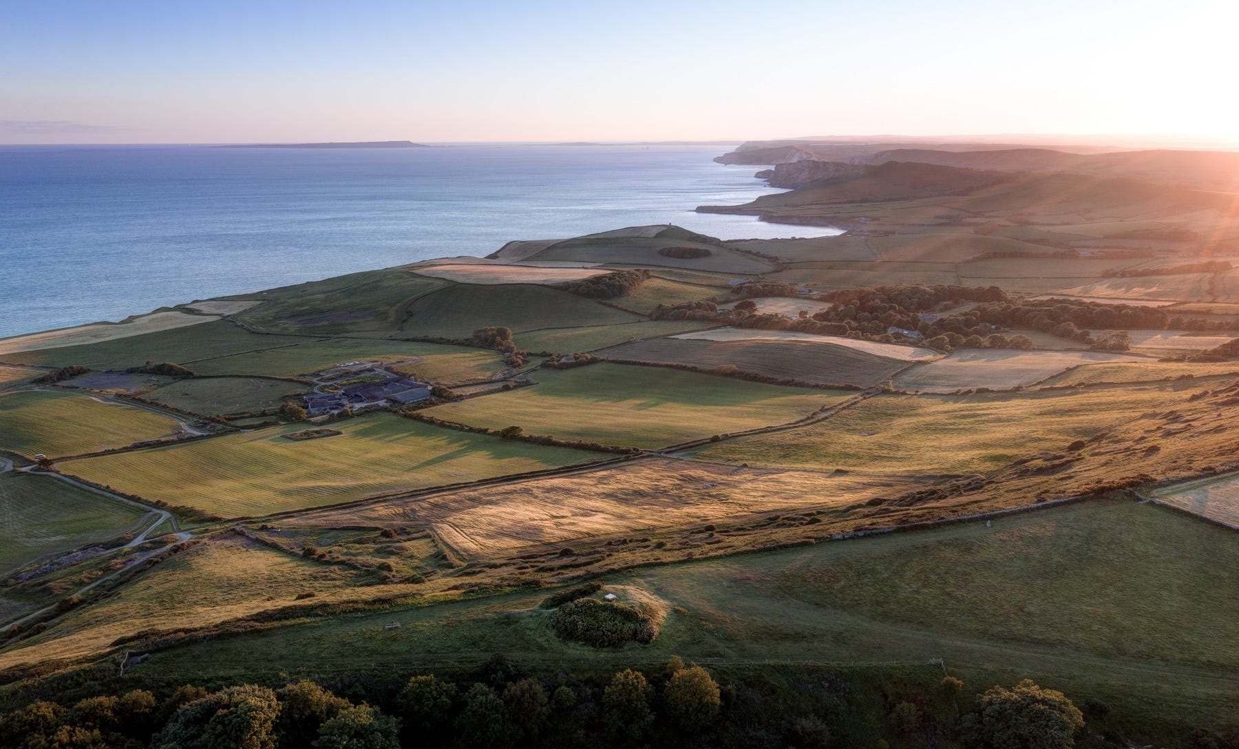
Swyre Head
No discoveries excite me more than ones I make in places I already know - or thought I knew - very well. I’ve been exploring the Dorset coast since my teens, yet only by following ancestral signposts (in this case, lines of visually interconnected hilltop barrows and scouring OS maps) did I find Swyre Head.
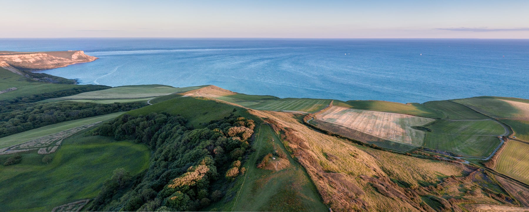
How could I possibly have missed it all these years? The highest point on the Isle of Purbeck, the limestone promontory tapers in dramatic fashion through the hinterland of Kimmeridge towards the cliffs of the Jurassic Coast, forming a spear tip of land from which a magnificent panoramic view over to Portland and St Aldhelm’s Head is revealed.
It was here that herder-farmers in the Early Bronze Age constructed the most impressive burial mound in the region, measuring nearly 30m across and 3m in height. The general consensus seems to be that in medieval times the tumulus was re-modeled to accommodate a windmill (a single plinth of polished stone crowing the burial mounds is seemingly the sole remnant of this structure). The earthwork remains, however, a wonderful piece of prehistoric land art.
This is truly somewhere to come to contemplate the vastness of time and wider cosmos. If you’ve visited Steve Etches’ fossil museum in nearby Kimmeridge, you’ll be well aware that hidden beneath the grass and undulating clifftops below are the calcified skeletons of giant plesiosaurs and other sea monsters. I found myself wondering what our ancestors would have made of these enormous fossils that periodically crumble from the cliffs, and what explanations or stories they may have come up with to account for them . . .
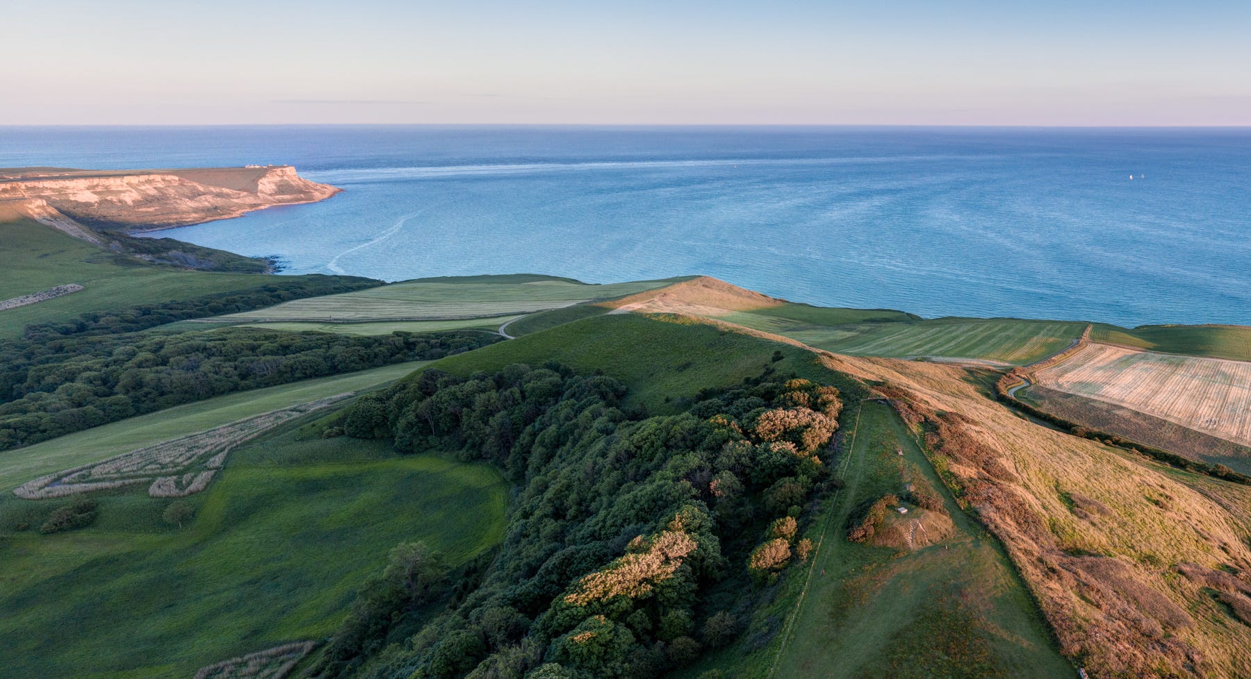
The barrow on Swyre Head, with St Aldhelm’s Head top left
As you can see from my photographs, this was an evening of exquisite light - a great rarity this past year or so. Soaking up all that space and heavenly summer colour as I walked back along the scarp edge of the promontory felt like a gift from the ancestors, without whose eye for a sublime spot I’d never have found this special, pivotal point in one of Europe’s great coastal landscapes.
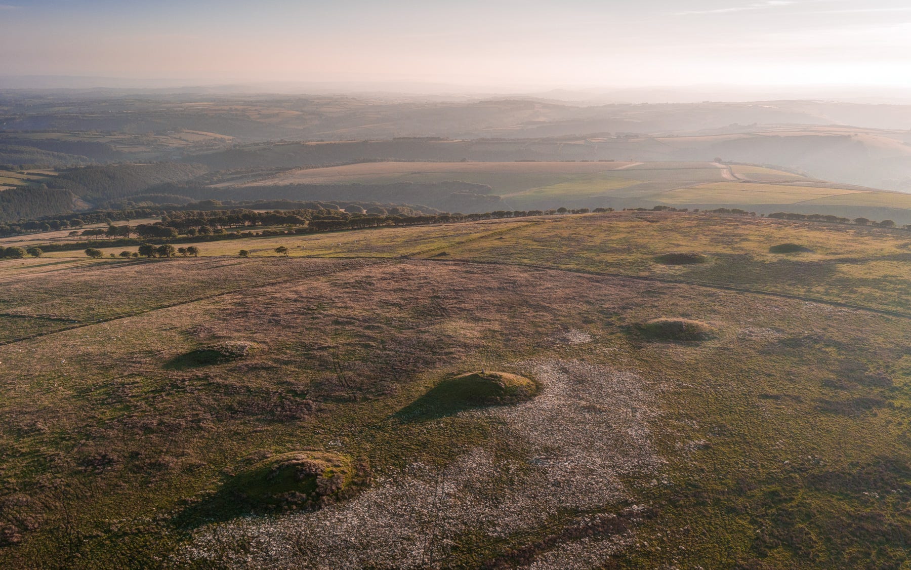
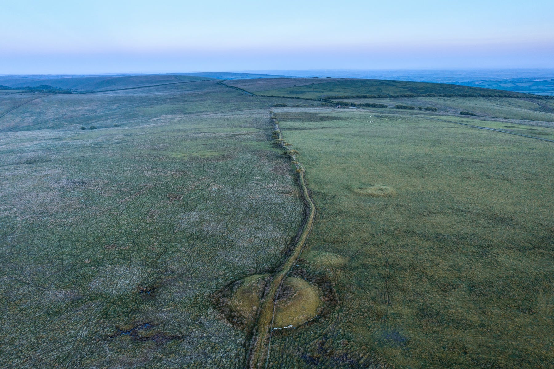
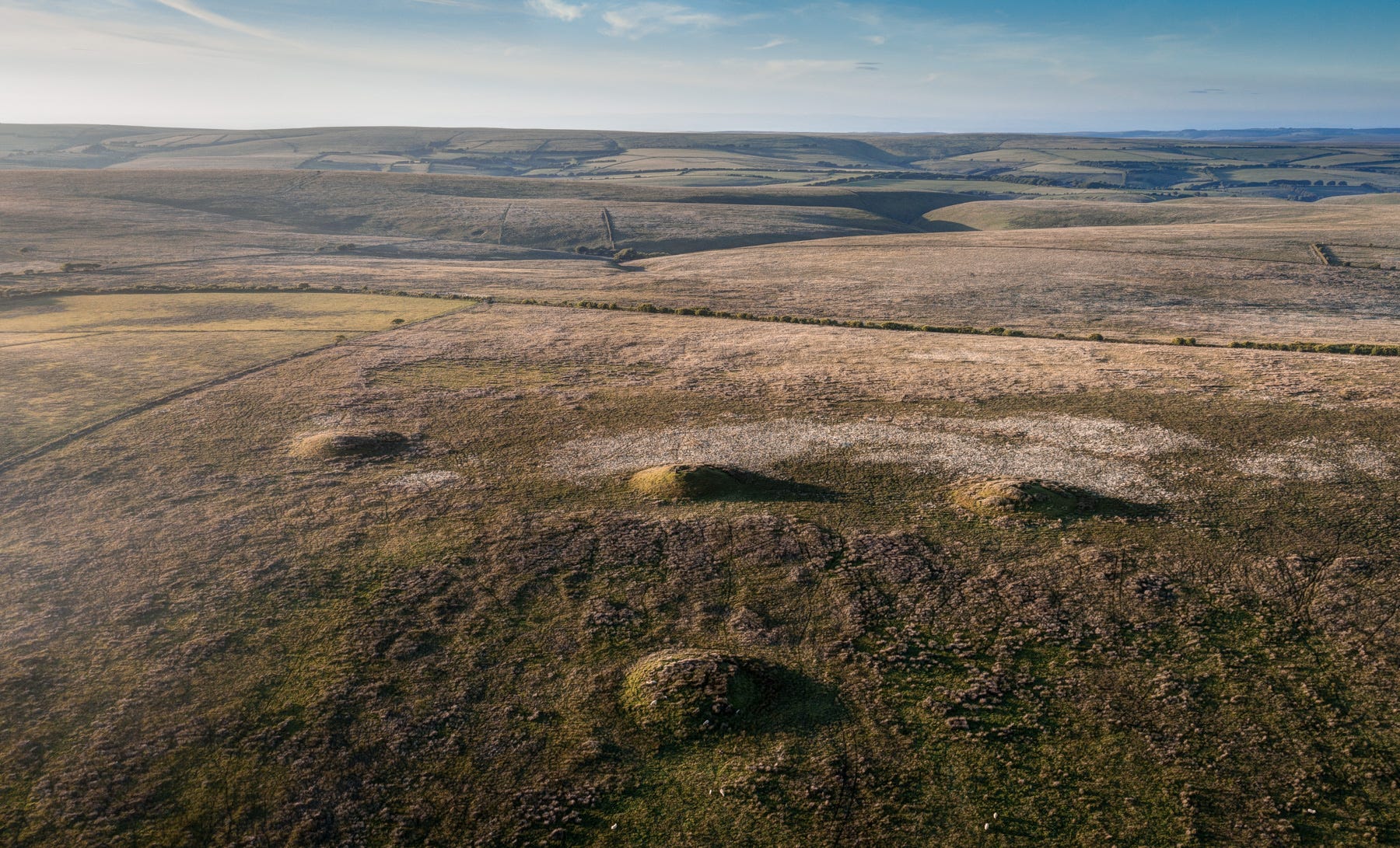
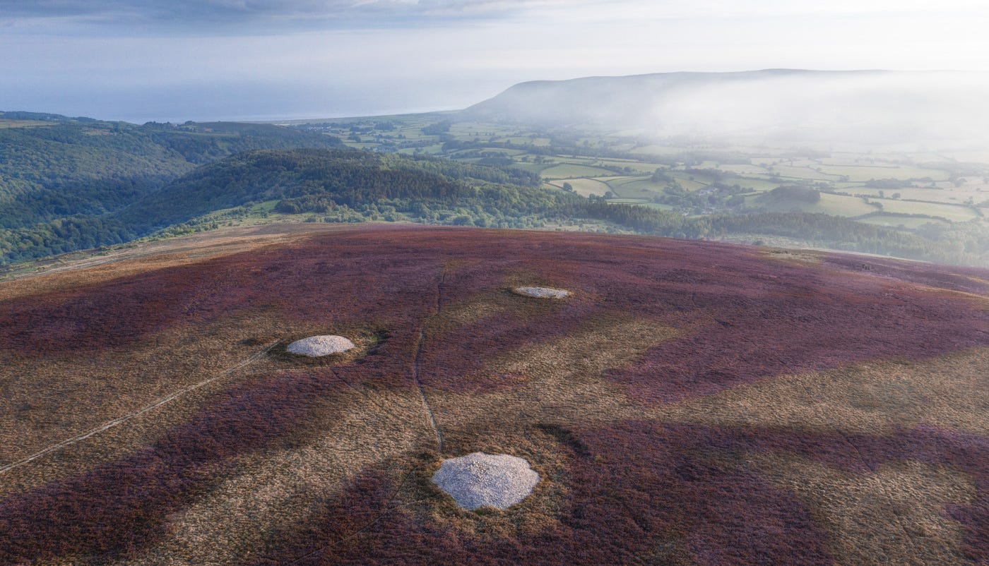
Five Barrows Hill, Exmoor
From Swyre Head, we spotted another, equally large burial mound to the north that will require further investigation. A similar thing happened about a year ago while I was exploring the Chains on Exmoor, from where I saw a spectacular phalanx of barrows to the southwest, on what my OS map identified as ‘Five Barrows Hill’.
This was a much harder place to reach, requiring a long, convoluted drive, some rough walking and an overnight camp. But the effort was more than worthwhile. What a site. There are actually nine barrows in the batch, the most prominent of them the six shown above, which adorn a moorland hilltop looking out across a patchwork of fields to Bideford Bay and the Taw Estuary, gleaming brightly in the late-evening sunlight.
The only signs of life as I climbed across the tussocky ground below were burbling larks and a herd of insouciant Exmoor mares, grazing contentedly with their new-born foals.
The journey to this remote vantage point, from the north coast of Somerset to the high ground further inland, then on through deep, winding combes thickly forested with beech and ancient, twisted oak, had been a revelation. This corner of the country remains astonishingly pristine, and little explored compared with Dartmoor, which makes these barrows all the more alluring.
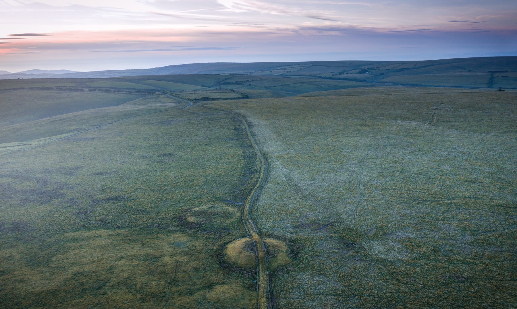
Most flank the great trackways stretching across the ridges that run from west to east, towards the Quantocks, Somerset Levels and Mendips Hills. Dating in some cases from the distant Mesolithic, these have been surfaced in places, but here remain mere corduroy ribbons of dark, puddly mud scything over empty expanses of blanket bog and heather.
The two largest concentration of barrows (the Chains/Chapman’s group, which I described in a previous post) and these, on Five Barrows Hill, both occupy southwest-facing spurs. I think this is significant. I noticed the same phenomenon in the Black Mountains of West Wales.
My hunch is that the proximity of the ocean was key. Time and again, the placement of a Bronze Age cemetery seems connected to water. Rivers, I believe, were construed as a metaphor for life - their sources equated with birth, their convoluted courses with the twists and turns of existence, and their arrival at the sea, death and eternity. And so it should be no surprise to find some of the most striking high-status burials from the era occupying land that overlooks the shoreline - in this case a dramatic sweep of North Devon, culminating with Hartland Point - that rugged, angular, intimidating outcrop known to the Romans as the ‘Prmontory of Hercules’ (the nemesis of so many ships over the centuries).
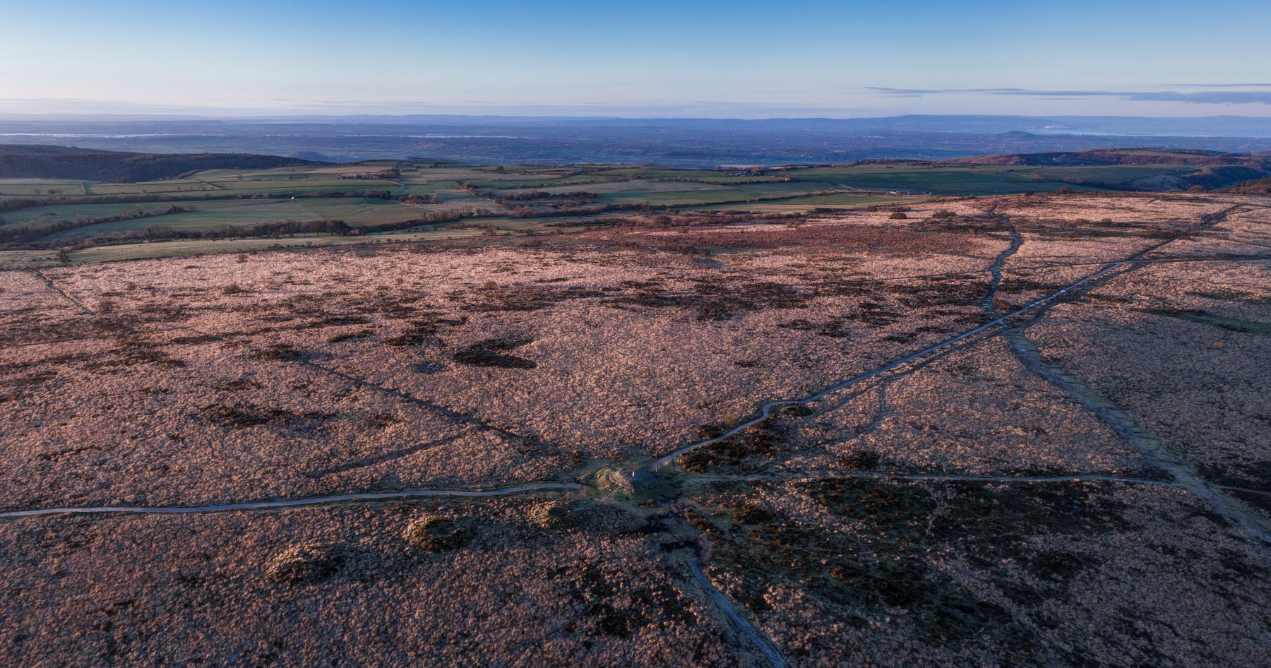
Setta Barrrow
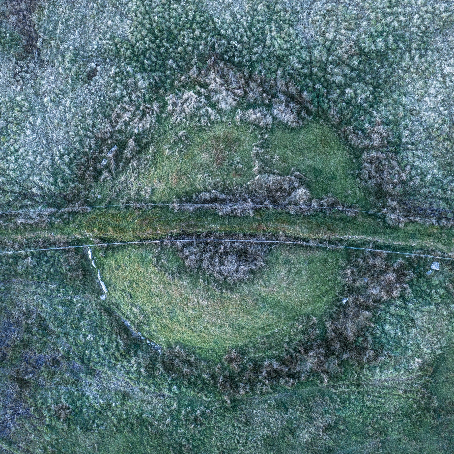
A mile or so northwest of Five Barrows Hill lies another group, the largest and best preserved of them the mighty Setta Barrow. In common with others on Exmoor, Setta straddles the course of the county border (between Devon and Somerset), which is followed by one of the region’s characteristic drystone walls. Viewed from the air, the structure forms a dramatic, sinuous centrepiece, flanked by the ghosts of lesser barrows, all of them retaining kerb stones of sparkling white quartz.
Moments after I took the photo above, I heard an odd rumbling sound behind me and turned around to see a herd of huge bullocks silhouetted against the western skyline, galloping towards me at a great speed. I found myself having to make a snap decision - whether to fly or fight! Normally, I’d have stood my ground. But these chunky chaps clearly meant business, so I packed my bag at eh double and, leaving my drone hovering a hundred feet above, made a beeline for the nearest fence, about 400m away.
Alas, the beasts were closing on me more quickly than I seemed to be reaching the fence. But, after a sprint I literally thought might kill me, I got there seconds before they did and managed to chuck my bag over, wrap my jacket around the barbed wire and vault the fence before those ginger devils managed to make my acquaintance.
For some reason, other people seem to find this story a lot more amusing than I do.
The main thing is, I got my shots (and managed to fly the drone to safety before it ran out of batteries).
I’ve now completed the chapter on Exmoor for my next book, ‘Barrowlands’, which will feature photographs from no less than six separate trips to the area, including to the hillcrest just northeast of Dunkery Beacon, where I found this wonderful group of cairns overlooking Porlock Bay - surely one of the most heavenly spots on Britain.
The Heather Cairns, Robin How and Jaoney How, Exmoor
News
That’s just about it for this edition. Just a quick reminder that I’ve a few big gigs coming up, where I’ll be projecting some of these recent images on big screens. On Wednesday 26th June, I’ll be at the Chalke Valley History Festival, talking at 12.30, as part of this stellar line up. From there, I do a mad, ginger-bullock-style dash to Glastonbury Festival, where I’m appearing on the new Woodsies Tree Stage at 10pm, or thereabouts.
Finally, on Monday July 8th you can see me at the Merlin Theatre in Frome, where I’ll be doing an extra special show based on my latest Barrowlands material. Tickets are selling very well, so book ahead here to avoid disappointment.
And finally . . .
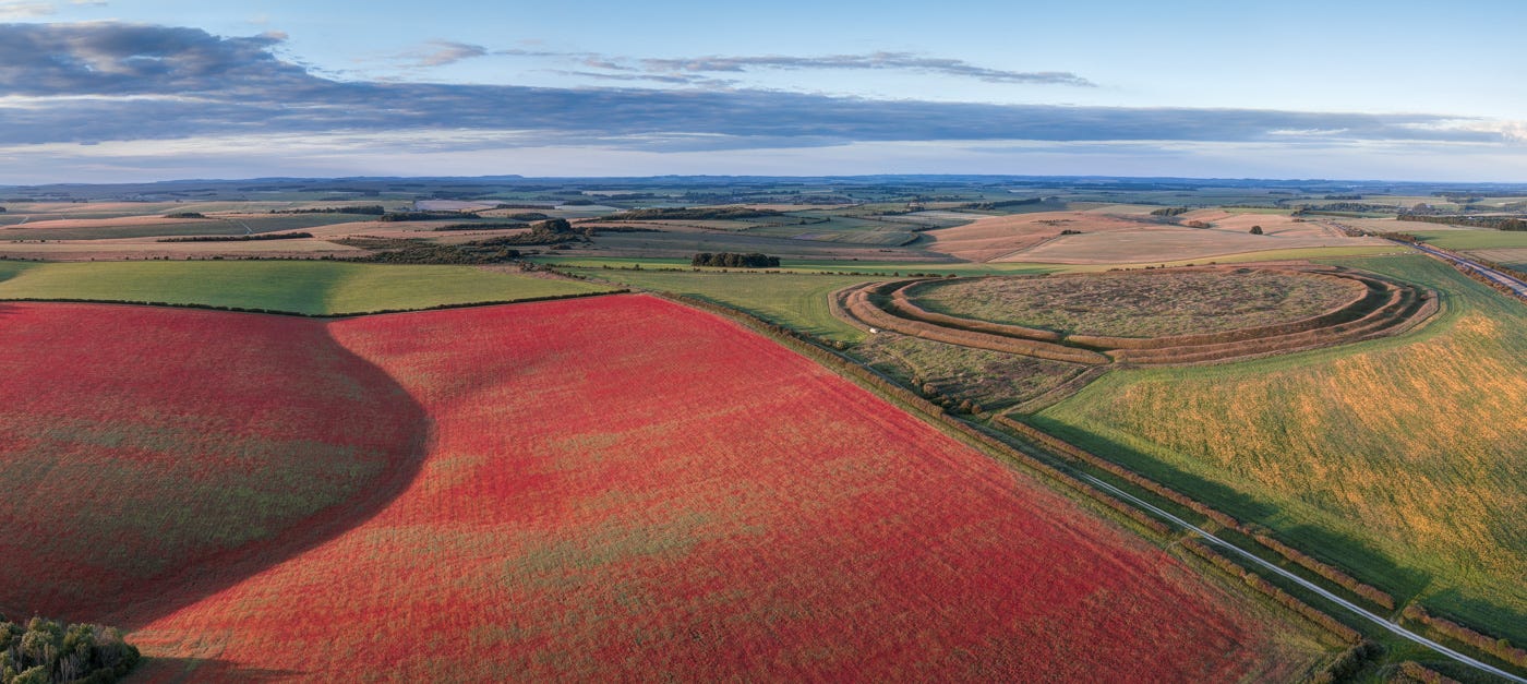
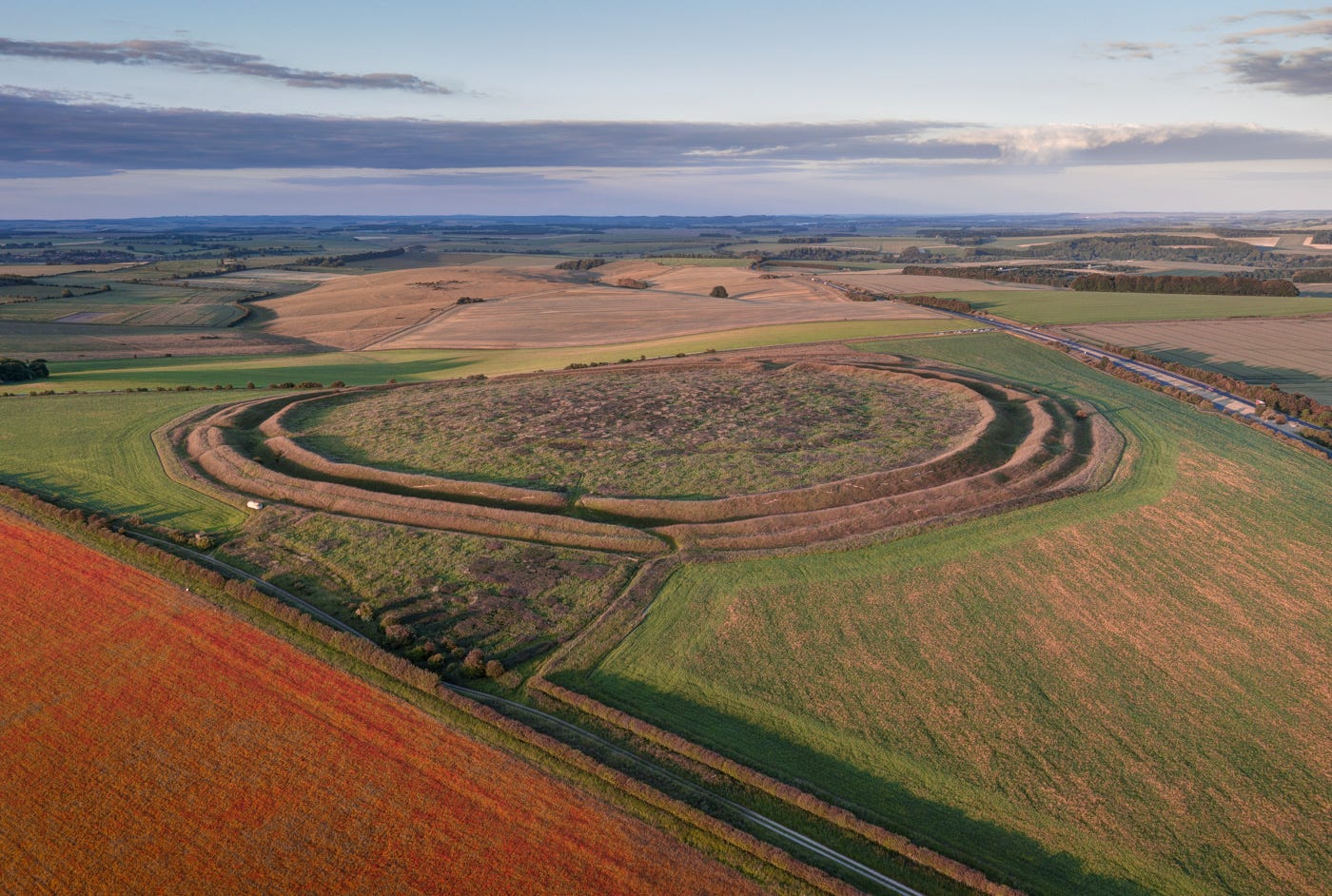
For at least nine years, I’ve been trying to get an aerial shot of Yarnbury Camp, an Iron Age hillfort in Wiltshire not far from Stonehenge, with the poppies blooming in the surrounding fields. This has proved very difficult, poppies having gone the way of bees lately (for similar reasons one suspects). But this week, a post on Instagram by a local photographer alerted me to the fact the poppies were back - and how!
I dashed over there on the only sunny evening of the week and managed to get a couple of shots, which I look forward to unveiling at my forthcoming shows.
Here’s a sneak preview:
Thank you for reading to the end of my Newsletter! If you enjoyed it, please click the ‘like’ button, drop me a line and recommend my page to friends and family members.
Once again love your photos and thoughts in the possible beliefs - they're great inspiration for my prehistoric fiction-writing brain. I also know from first hand experience that encounters with bulls like that are no laughing matter!
The photos are beautiful!