Places Apart
The Sacred Hilltop Enclosures of Early Neolithic Britain

The impulse to gather for rites of passage, or to mark important dates in the annual calendar with ceremony, is common to most societies, but especially those whose populations are widely dispersed. Around 3,700 BC, Neolithic herder-farmers started to create hilltop enclosures across southern Britain where they performed funerary rituals and feasted over the summer and winter solstices. The tradition, seemingly first introduced from the Paris Basin, spread rapidly across the Chalklands of Wessex, where rough circles of segmented ditches were cut into the soil on hilltops to create sacred spaces. Often sited at geological borders, where one kind of rock or landscape segued into another, the sites enjoyed expansive views, frequently overlooking the sources or confluences of rivers.
Offerings of pottery sherds, struck flint, polished stone axes and animal bones - especially ox skulls - were ceremonially deposited in the ditches or pits dug into the earthworks, along with human remains. Scratch marks on them made by stone tools suggest the skeletons were dismembered and stripped of their flesh in situ (a practise known in archaeology as ‘excarnation’). Such funerary traditions are still practised in remote parts of Tibet, where they’re known as ‘sky burials’. Zoroastrians in western India also traditionally dispose of their dead in this way, in order not to pollute the sacred earth or fire.
The appearance in the British landscape of these ‘causewayed enclosures’ coincides with something of a peak in the Early Neolithic revolution, when the recently introduced way of life becomes firmly established and regional identities start to take shape. By this time, two or three centuries after the first herder-farmers arrived in the southeast, large patches of forest had already been removed. With the expansion of cereal cultivation and herding, pressure on land increased greatly, along with the population. As communities grew in size, the old timber halls erected by the first few generations of pioneers fell into disuse and people dispersed across ever widening territories, converting more and more woodland to garden plots as the soil of older ones became exhausted. With such an expansion, the need must have arisen to congregate periodically with people from different areas – to trade animals and seed grain, to contract marriages and perform seasonal rituals to ensure the fertility of the earth.
Herding and cereal cultivation not only boosted the population, but also energy levels. By generating surplus food, people in the Early Neolithic were able to devote weeks, or months, to digging and re-cutting the ditches. Indeed, their creation and maintenance, uniting kin and clan members from wide areas, may well have formed part of the rituals themselves.
Archaeological digs at the enclosures have yielded vivid insights into life in the first half of the fourth millennium BC. From the age of the cattle slaughtered and size of domestic pots, for example, we know the encampments were not permanent settlements, but places inhabited only for short periods.
Ritual specialists and the region’s top tool makers would have bartered their wares during the festivities, exchanging polished greenstone axes hewn from crags overlooking the Menai Straits or high valleys of Scafell Pike for lambs, suckling pigs and bullocks fattened on the grasslands. Oxen laden with hides, fleeces, baskets of salt, red deer antlers and rolls of soft buckskin would have been walked for days to the sites by their owners before being slaughtered for the feasts, in which roast pork, beef and marrowbone were mopped up with flatbread made from emmer wheat ground on sandstone querns.
Alongside the religious ceremonies, there must also have been less formal events – perhaps tellings of epic tales around the campfires at night, as well as music and masked dances enacting legends from the time of the Ancestors, when the land was created and the great lineages established – stories of hunts, floods, forbidden love and strange, mythic beasts. And, of course, there could well have been intrigue and misbehaviour, fuelled perhaps by intoxicants. Neolithic people knew how to malt barley and are believed by some archaeologists to have brewed ale. A grape pip was found at one enclosure in Dorset, suggesting wine may even have been consumed, while at another in Cambridgeshire the seeds of opium poppies were discovered.
At some point, however, what appear to have been largely harmonious gatherings took a sinister turn. On Hambledon Hill in Dorset and Crickley Hill in Gloucestershire, large-scale violence erupted in the 35th and 36th centuries BC. At the former, parallel banks and ditches with huge timber-boxed reinforcements and a massive gateway were built. A two-hundred-metre stretch of these walls were at some point stormed and set on fire. Skeletons were found buried amid the charred remains of the palisades, amid chunks of scorched clay, with leaf-shaped arrowheads embedded in their ribs.
We do not know what precipitated such conflagrations, but this period was one during which the climate deteriorated. Crop failure from drought and soil exhaustion seems to have caused a drop-off in population as people deserted their former arable plots, retreating to the uplands with their livestock.
Due to their great age and destructive power of modern farm machinery, few causewayed enclosures are these days visible from the ground. But you can see a few of them from the air, particularly if you’re prepared to sleep on site in order to be there at dawn, as I’ve done on numerous occasions.
Here then is a selection of my favourite aerial images of causewayed enclosures. It takes a feat of imagination to picture them in their prime, with white chalk banks and ranks of timber posts delineating their various perimeters. And there are far fewer trees around these days, of course. But something of the original atmosphere of these places endures, I think, enhanced by the liminal sunrise light.
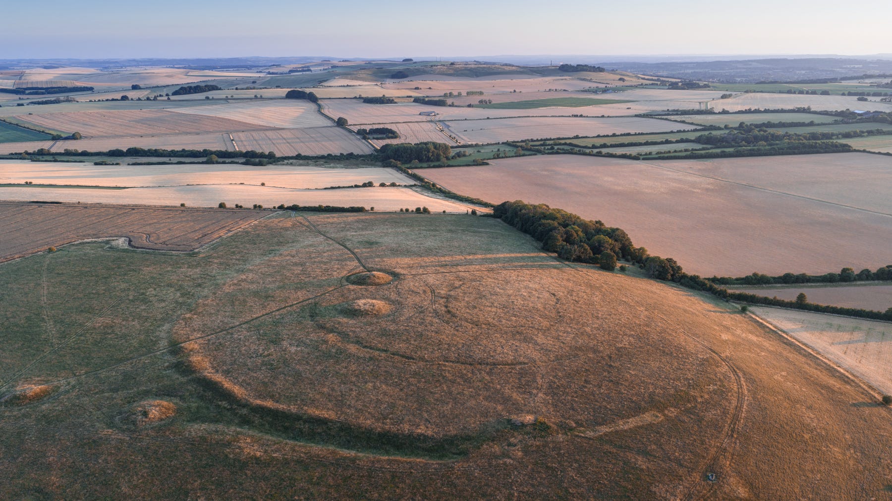
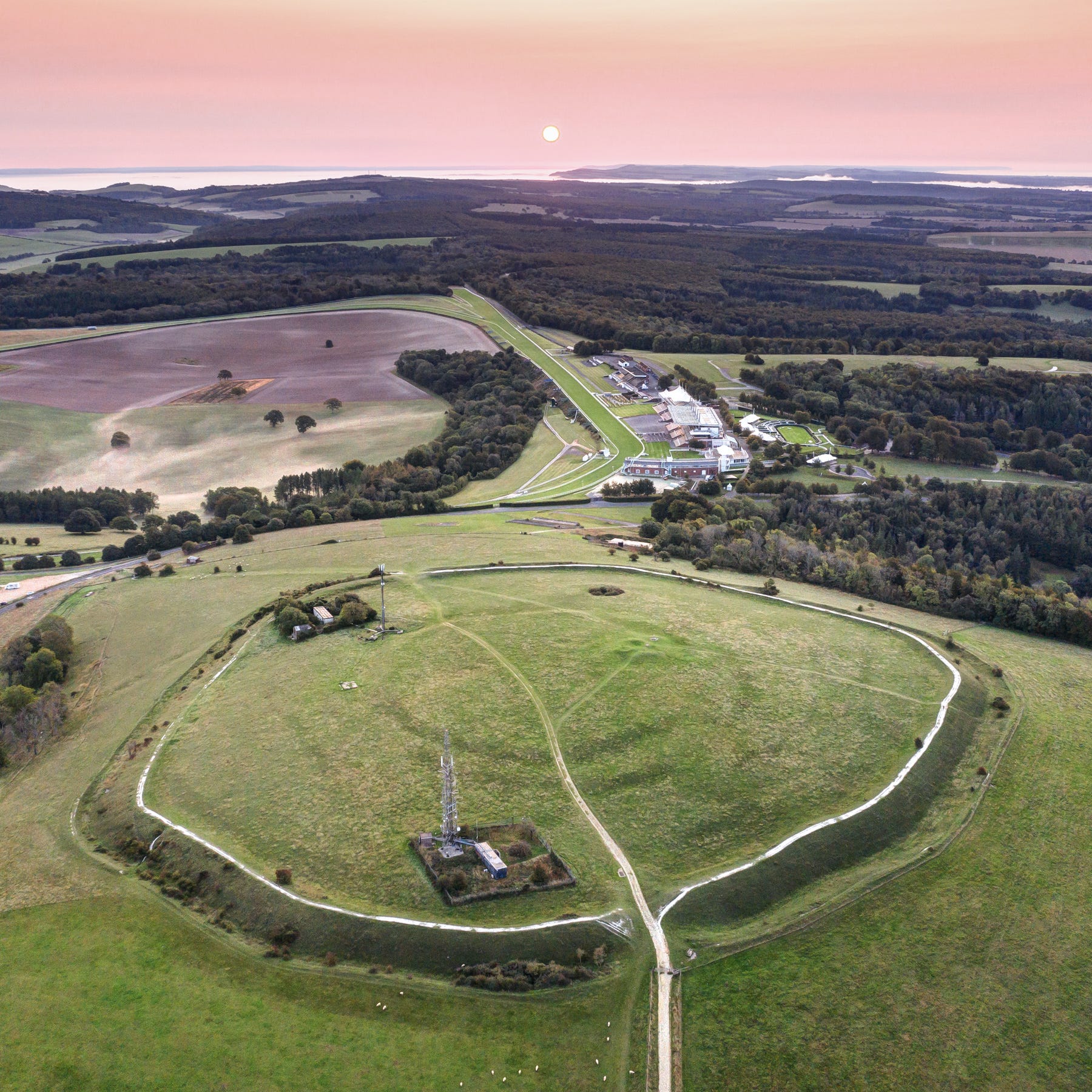
Windmill Hill, half an hour’s hike across the fields north of Avebury, is both the largest and most comprehensively studied causewayed enclosure in Britain. For many years after it was first excavated by Alexander Keiller in the 1920s, the site came to define the material culture and ritual activity of the Early Neolithic period in Britain. Although diminutive by the standards of British uplands, the hill boasts a sweeping 360-degrees view over the Kennet Valley’s hinterland of shadowy chalk ridges and its numerous long barrows. The exceptional fertility of the area that attracted Neolithic farmers here in the early fourth millennium is evident in this photo, taken just before the harvest.
Early Bronze Age barrows were built on Windmill Hill around 2,000BC. Their positions were chosen so that they appeared in perfect silhouette when viewed from the Great Henge a mile to the south.
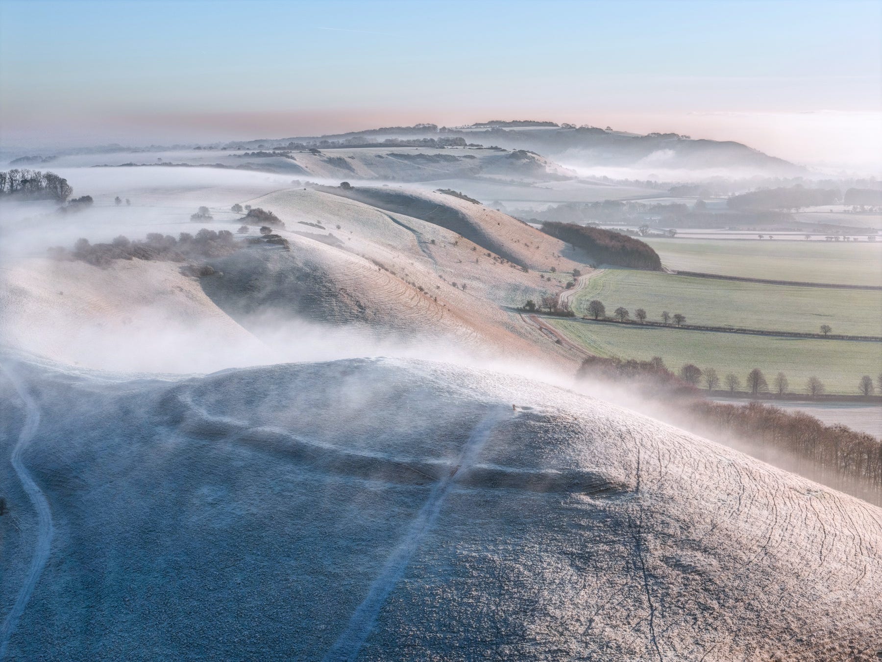
Knap Hill, on the Downs to the south of Avebury overlooking the Vale of Pewsey, is believed have been a ‘Sky Burial’ site. The ditches on its northern side remain prominent.
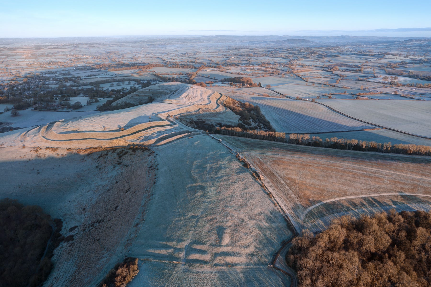
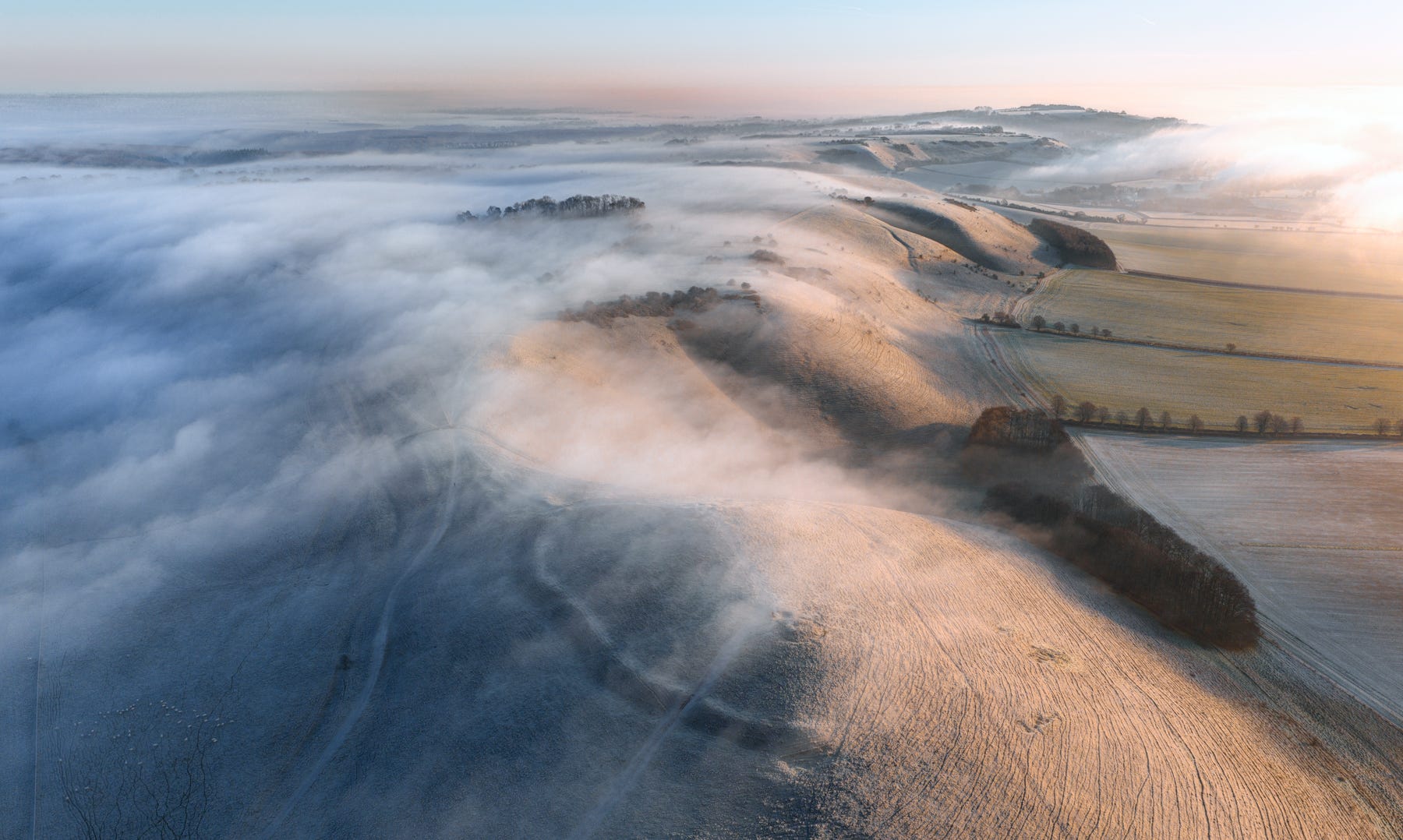
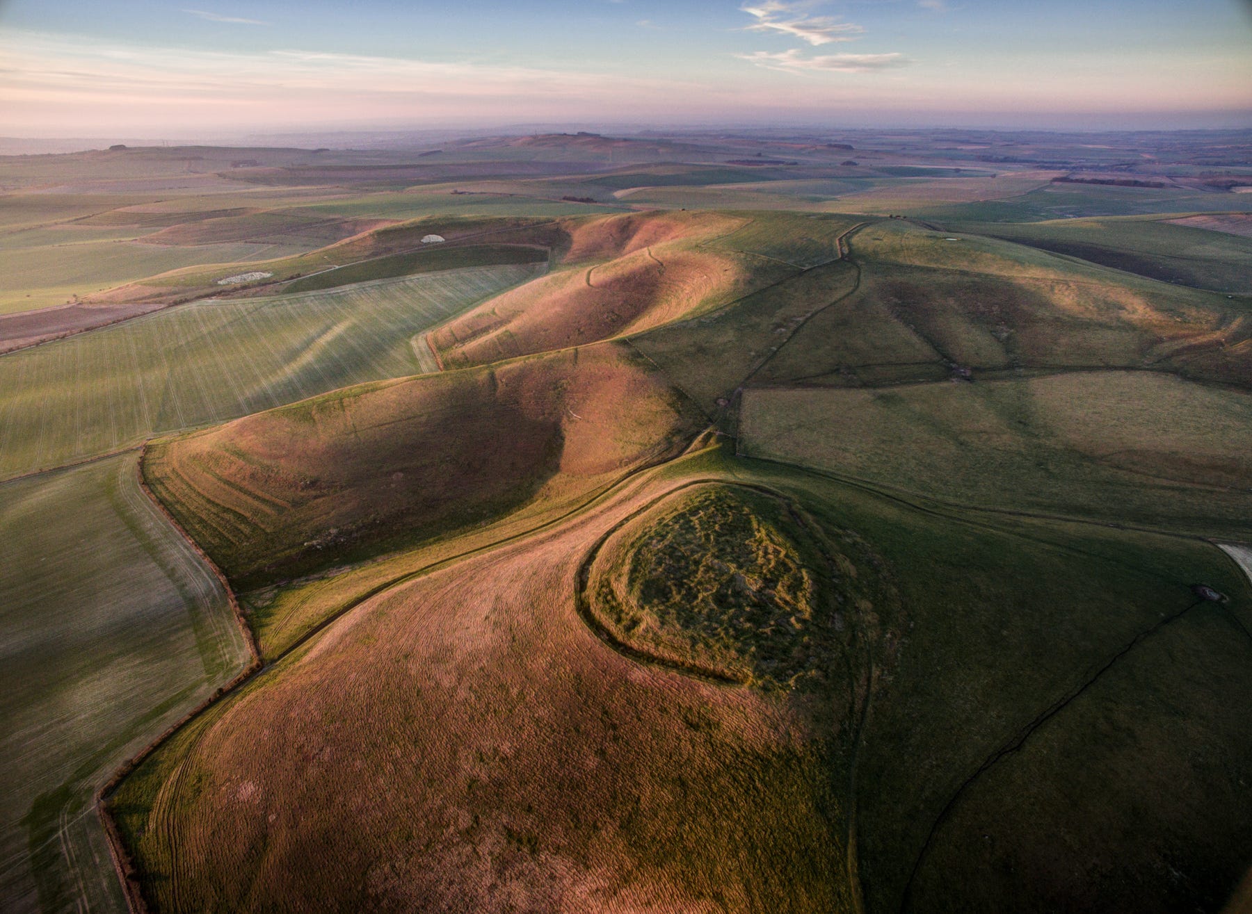
A faint pale outline, bisected by a hedge, is all that remains of the once impressive main enclosure on Hambledon Hill’s Shroton Spur. The older long barrow just outside it is today more conspicuous. The ramparts on the hilltop to the north date from the late Iron Age.
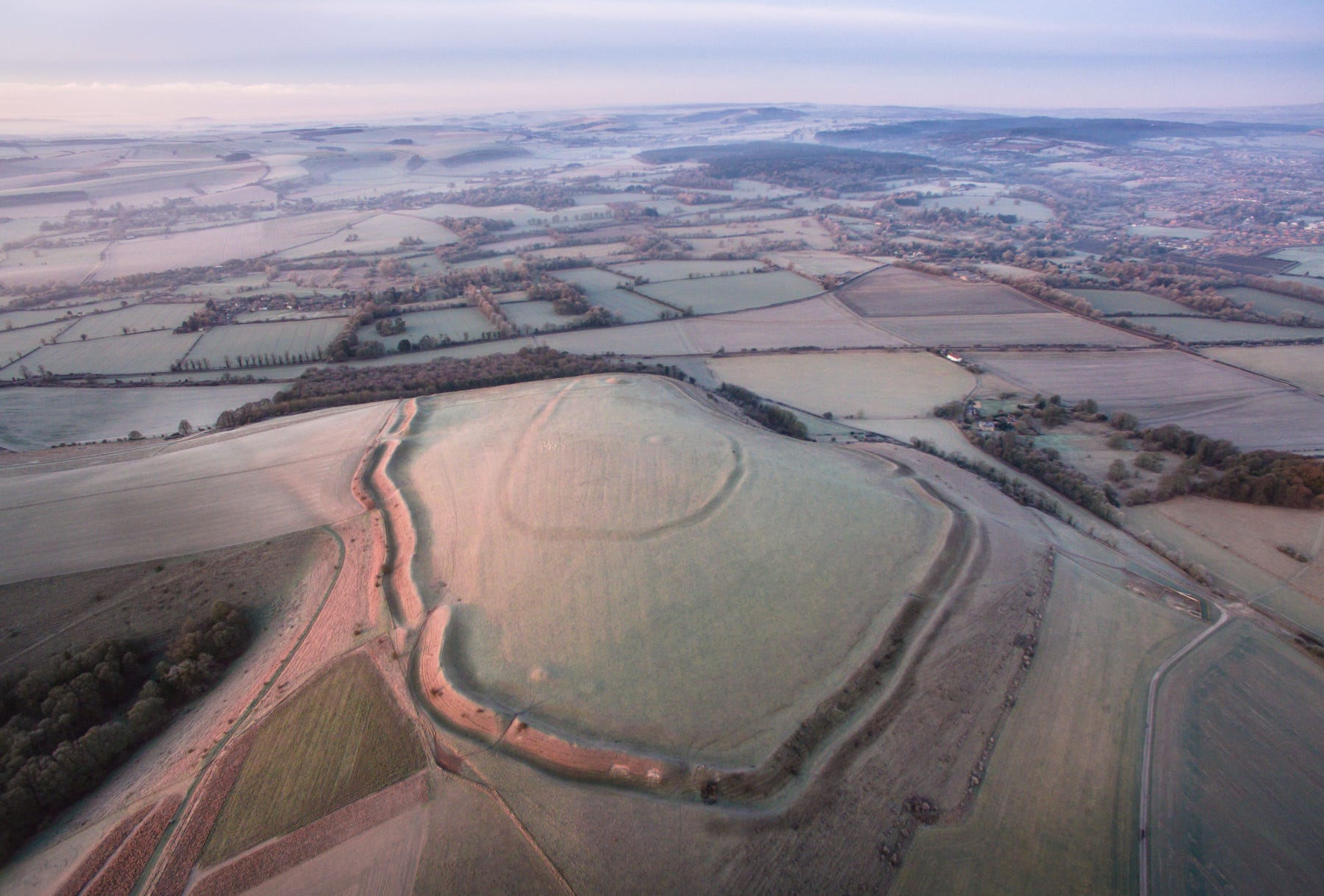
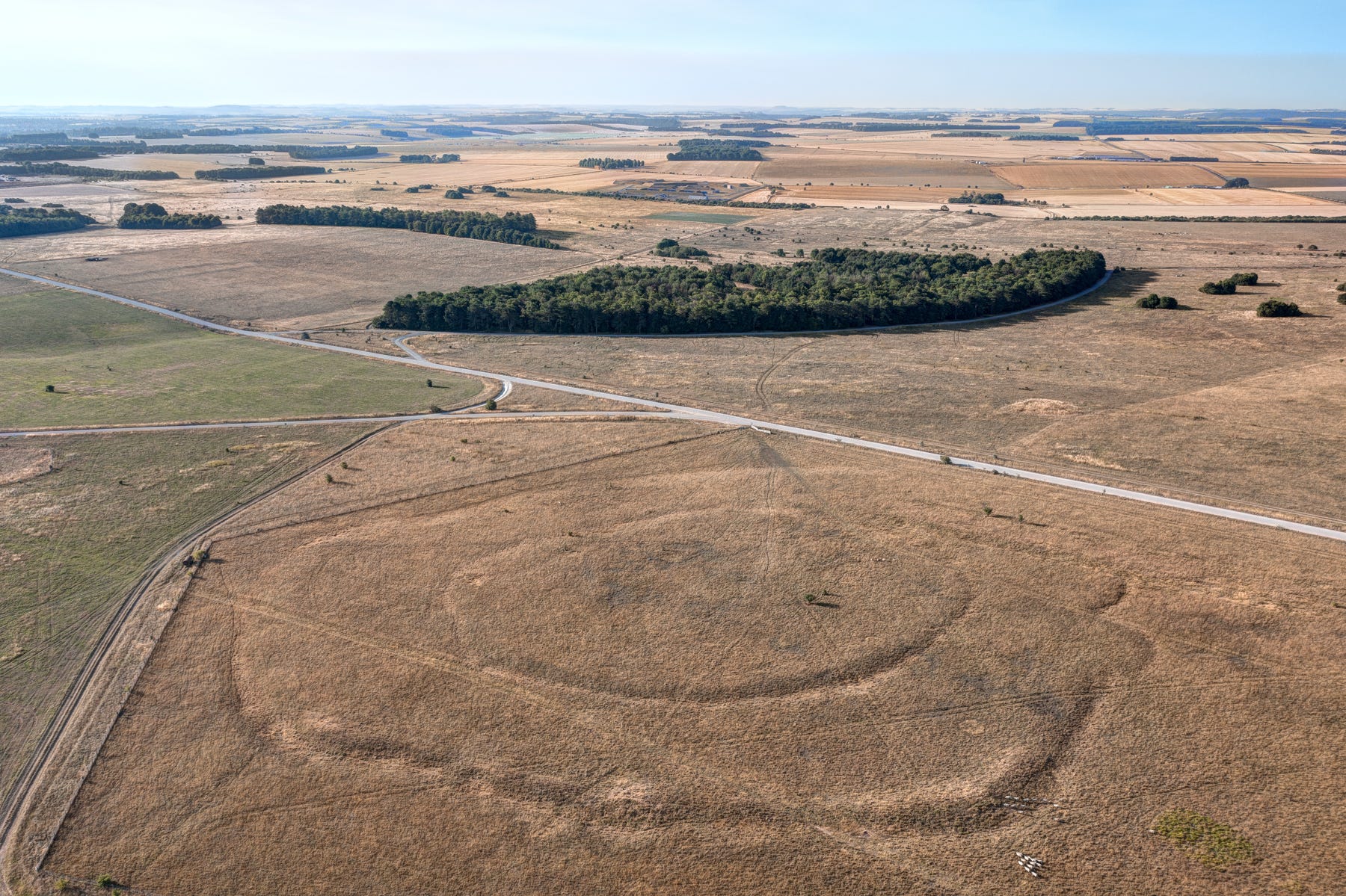
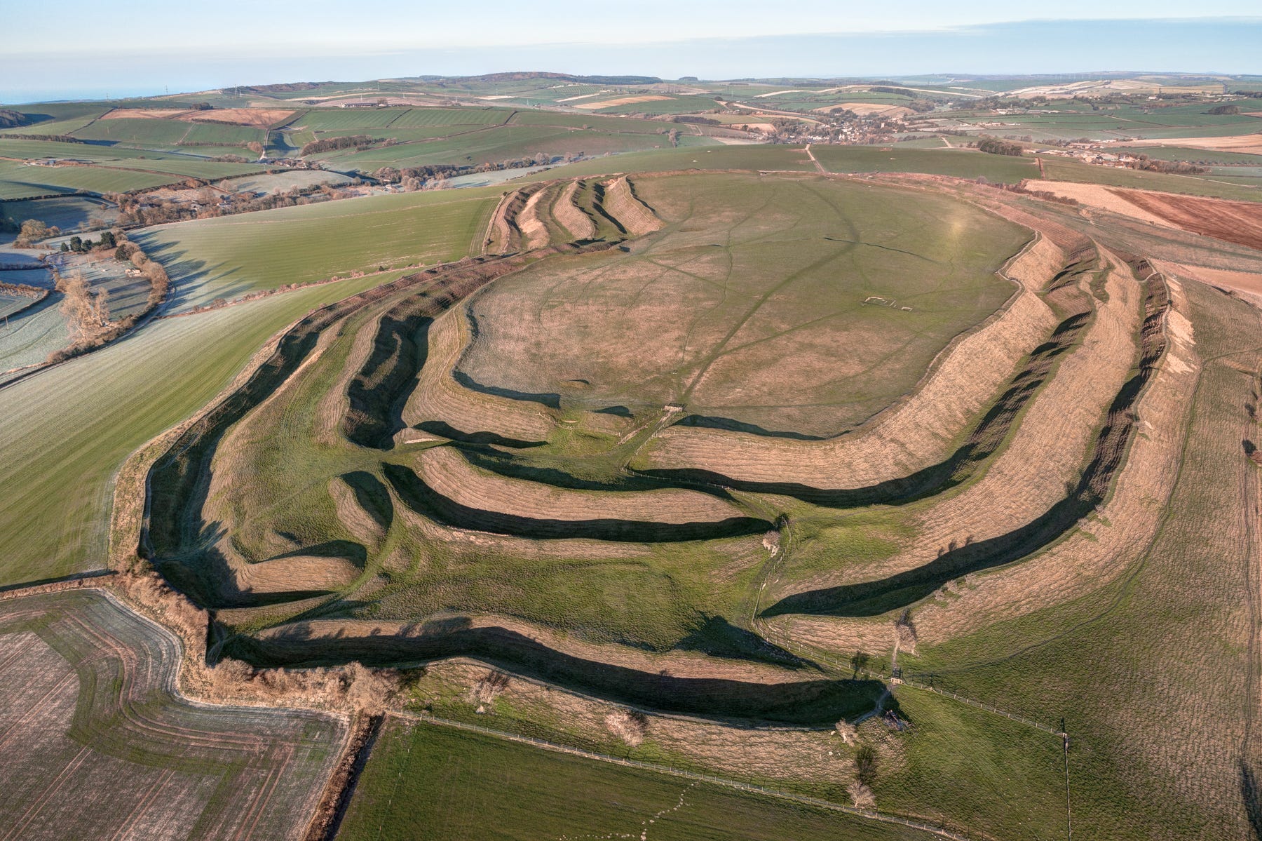
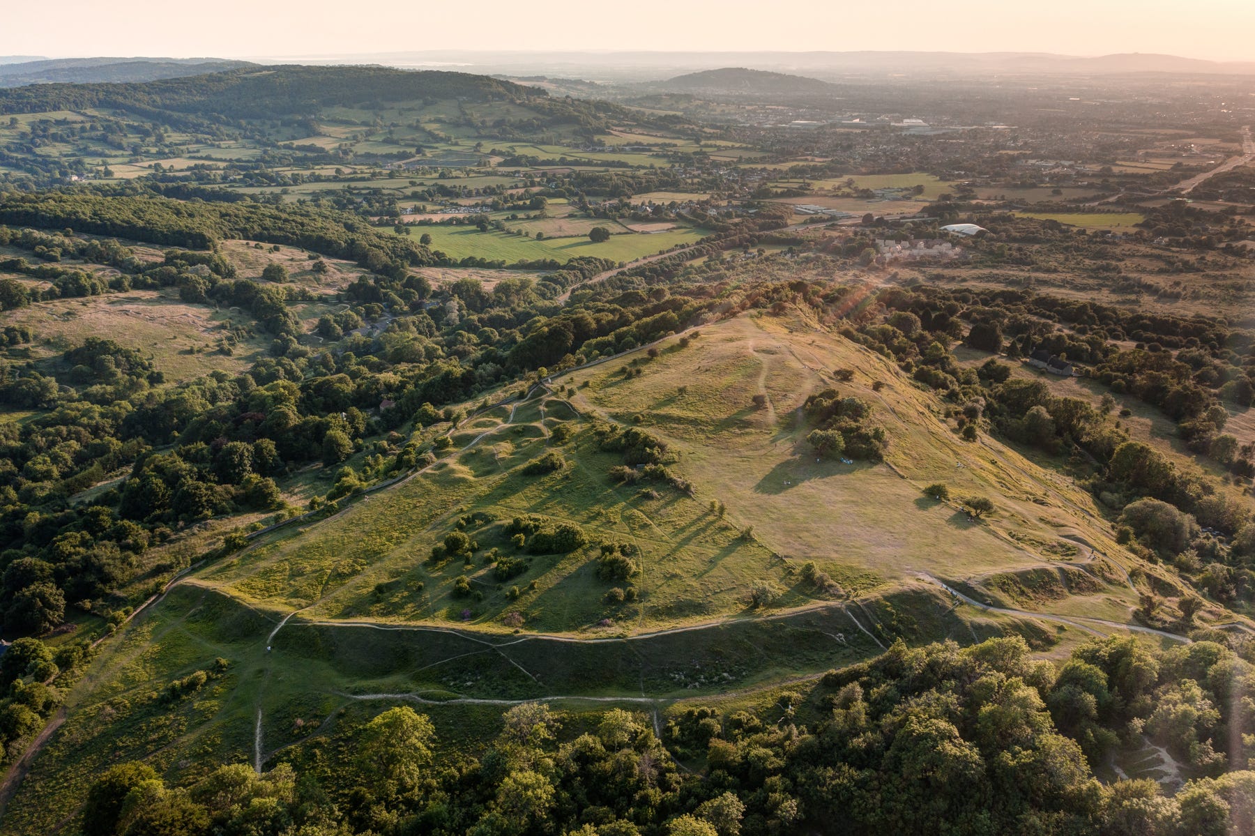
The central, ‘D’ shaped earthwork in the centre of this hillfort - ‘Scratchbury Camp’ on the outskirts of Warminster in Wiltshire, is believed to be the remains of a Neolithic Causewayed Enclosure.
Here’s another picture of the same site, looking east towards Stonehenge.
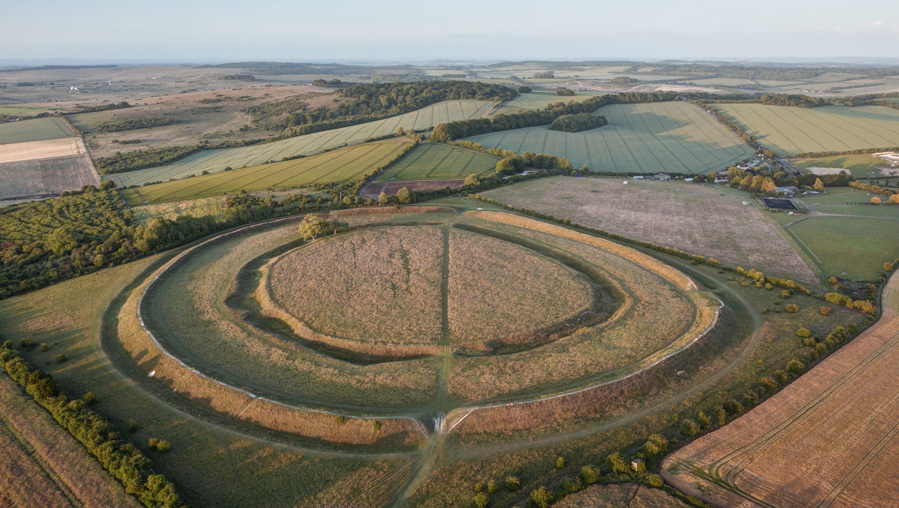
Figsbury Ring, outside Salisbury, is another example of a causewayed enclosure that was later remodelled as a hillfort. This was a difficult image to shoot as an invisible drone-proof wall extends around the perimeter of nearby Porton Down!
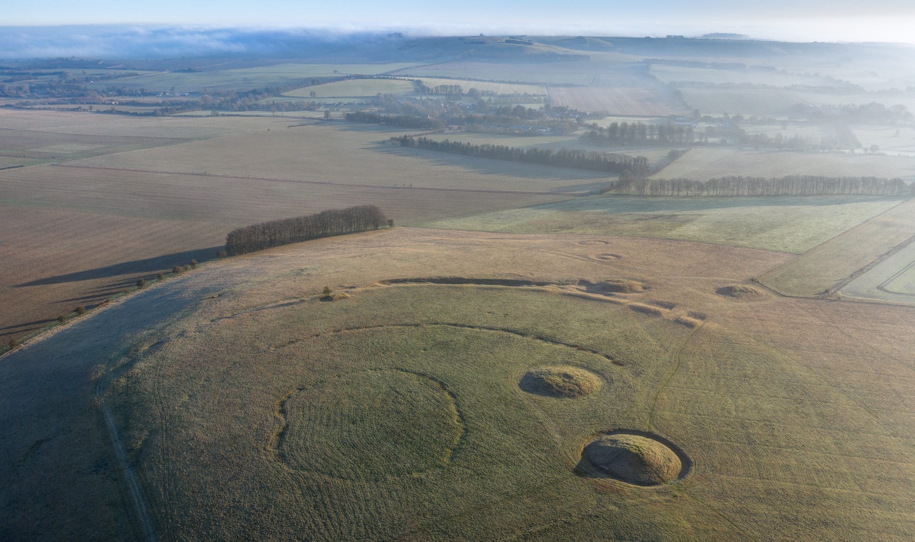
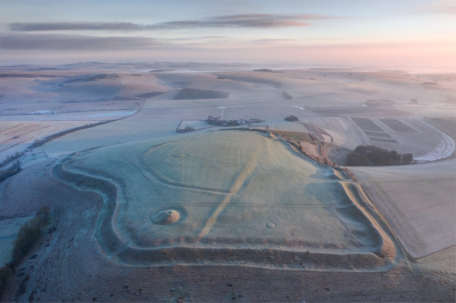
Robin Hood’s Ball, on the military range near Larkhill in Wiltshire, was created eight centuries before the sarsen trilithons were erected at nearby Stonehenge, a couple of miles to the southeast.
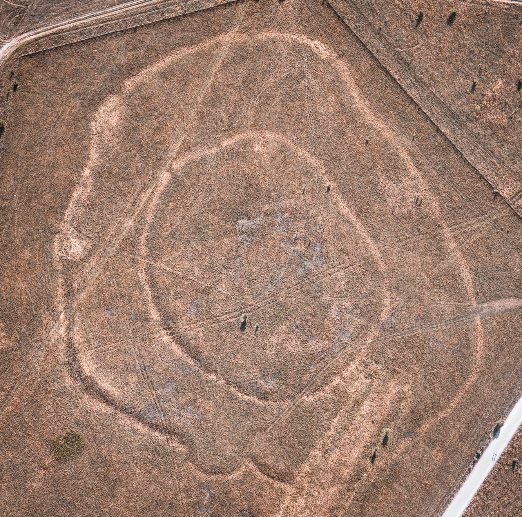
A rare top-down view of Robin Hood’s Ball.
That Mesolithic hunter-gatherers congregated on Crickley Hill in Gloucestershire we know from the discovery of bone fragments carbon dated to between 4,375 and 4,230 BC. Several centuries later, a pair of concentric causewayed ditches were dug around the hillcrest, enclosing a central cobbled-stone platform where blood sacrifices and rituals involving fire and depositions of bone, pottery, flint and antler appear to have taken place. Such a sophisticated assemblage clearly attracted unwanted attention midway through the fourth millennium, when one of the gateways into the enclosure was seemingly attacked and torched. Hundreds of typically Neolithic ‘leaf’ arrowheads were discovered among the charred remains.
Rybury Camp, on All Canning’s Down above the Vale of Pewsey - yet another Early Neolithic causewayed enclosure adapted for use as a hillfort in the Iron Age.
Overlooking Goodwood racecourse in West Sussex, the Trundle (from the old English ‘tryndle’ meaning ‘circle’) has received considerable attention from archaeologists since 1925, when its outlines were first spotted in aerial photographs. E.C. Curwen identified two circuits and a segmented spiral ditch within the more prominent Iron Age fortifications. Subsequent excavations revealed a mass of struck flint, animal bone, some unusual carved chalk blocks, a bone phallus and sherds of pottery. Carbonised residue on one of the latter was dated to 4040–3770 BC, placing the site at the very start of the Neolithic period in Britain.
Barely any visible trace remains of the Neolithic enclosure on top of Maiden Castle, near Dorchester in Dorset, but it’s easy to see why our ancestors chose this site just below the Ridgeway.
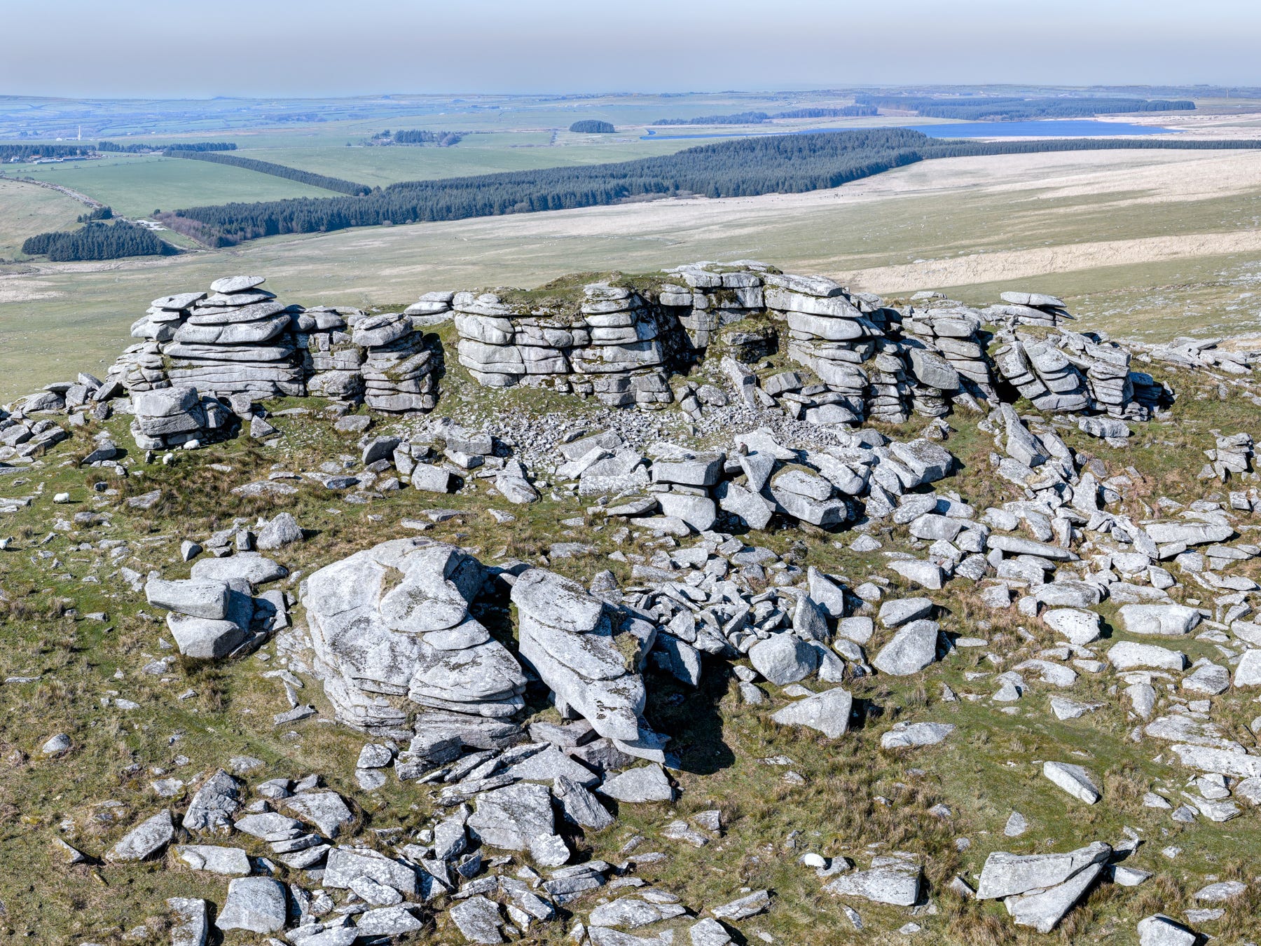
On Bodmin Moor in Cornwall, Rough Tor served as a sacred ceremonial enclosure in the early fourth millennium BC, only instead of digging a ditch around it, the area’s herders piled up drystone walls, sections of which can still be seen.
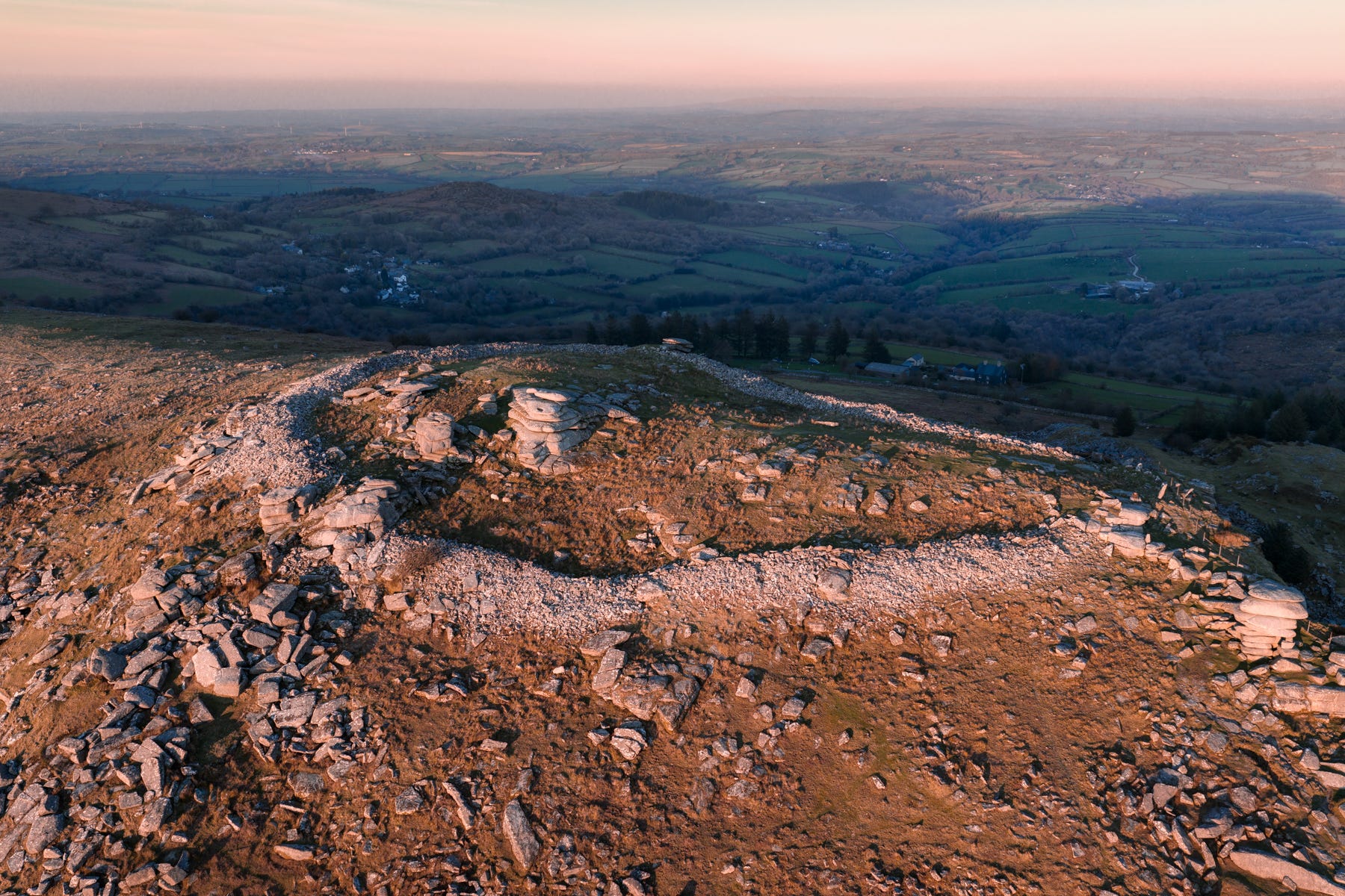
Stowe’s Pound, on the southeast side of Bodmin, may also have been used for funerary rituals, although its drystone wall dates from the Late Neolithic/Early Bronze Age.
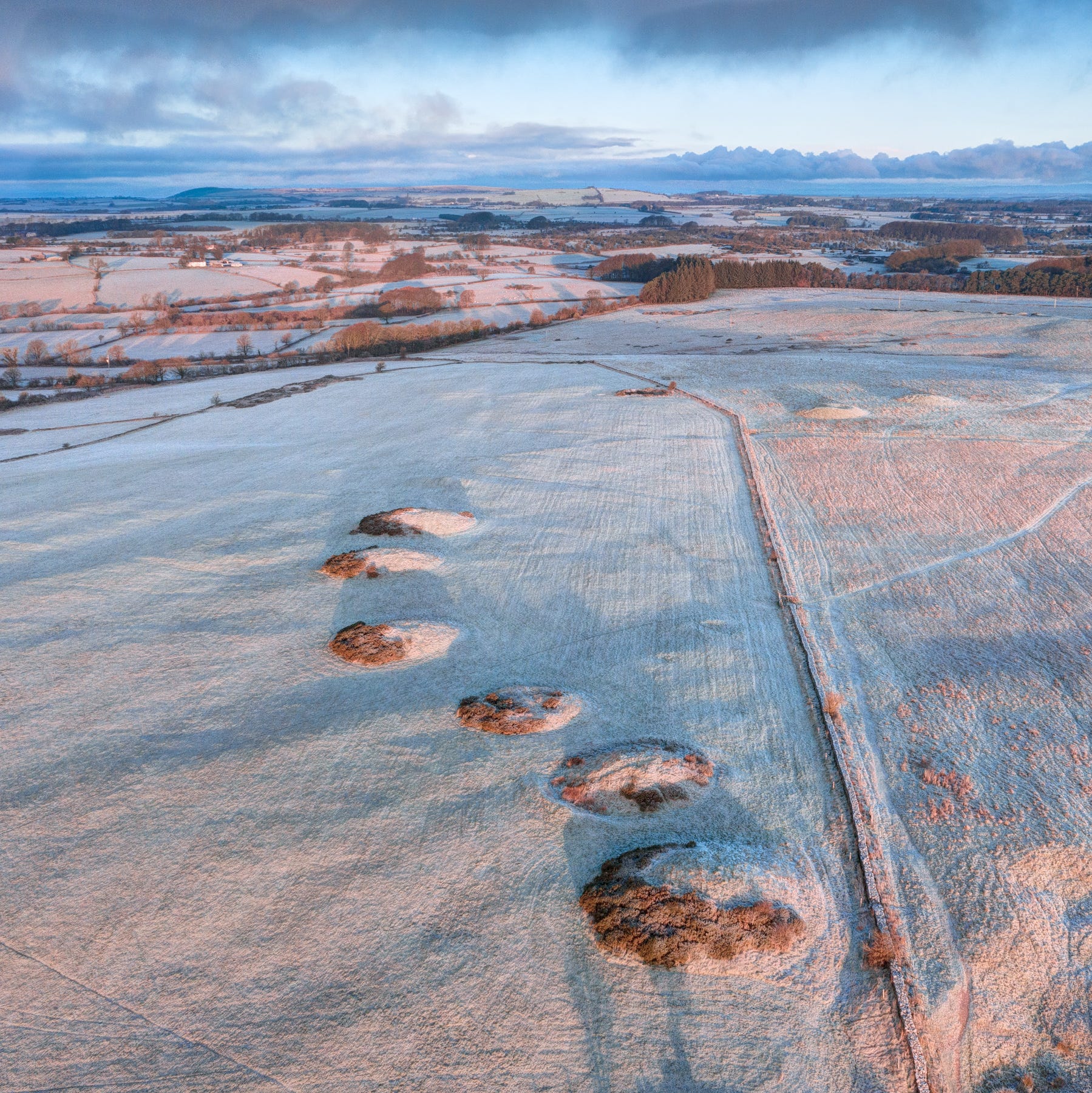
Thanks to ground-penetrating radar, new enclosures are still coming to light. Traces of one recently discovered by archaeologist Jodie Lewis on North Hill above the village of Priddy in the Mendip Hills of Somerset, can just about be seen in this photo bisecting the drystone wall beyond the Bronze Age barrows.
Thanks and News
Thanks for reading to the end of this article. If you enjoyed it, please give it a ‘like’ and a ‘share’!
I’ve written in more depth about most of these sites in my book, the Aerial Atlas of Ancient Britain, which ran out of print over the winter, but which will be back in stock very soon. Watch this space!
Finally, a big thank you to the six new paid subscribers who signed up after my previous post. Your generosity makes a genuine difference, encouraging me to post more frequently. And I’ll shortly be adding exclusive content for paid subscribers, so if you’ve been enjoying my Substacks, then please consider an upgrade
!
So thought-provoking, as usual! Always love the very human angle you bring to these sites... I drove past Figsbury Ring yesterday and was mulling it over, so very fresh in my mind!✨
Hi David, I started following you on IG a while back cant remember why! Anyway I read this post on ancient festival sites and wanted to get in touch about a place near me which I feel could be one of them. The current explanation for the site doesnt really add up for me. Anyway you can see more about it here: https://ukhillfortlidar.myportfolio.com/devils-ditches
If it seems interesting to you please drop me a line