The Missing Link
Neolithic Britain's Ultimate River Pilgrimage: Durrington Walls to Stonehenge

It’s a chilly morning in mid-April and the Stonehenge Visitor Centre is firing on all cylinders. The main concourse, a windtunnel with all the charm of an airport terminal taxi rank, is filled with people newly alighted from hire cars and tour coaches, their winter coats pulled tightly against a bitter easterly. A constant procession of shuttle buses trundles to and from the distant stone circle, some of whose passengers have paid nearly £300/head for a ‘once-in-a-lifetime chance to spend around 15 minutes alone in the stones’, according to the English Heritage online booking page.
It’s all a far cry from the days when we used to scamper around the site for free as kids, and further still from the last time I touched one of the sarsens, in Margaret Thatcher’s Britain of the mid-1980s, which ended in a terrifying charge on a crowd of very stoned, bleary-eyed festival goers by mounted police waving truncheons. Back then I could run the 200 metres in twenty-four seconds – a talent that came in useful that morning.
Today, I’m here to see the wonderful new reconstruction of a Neolithic hall, erected by the Ancient Technology Centre on Cranborne Chase and their team of volunteers, under the direction of experimental archaeologist Luke Winter. The structure, along with the adjacent cluster of small thatched huts built over a decade ago, was intended to replicate as closely as possible one whose footprint was unearthed a few miles northeast at Durrington Walls. This was the prehistoric settlement where the makers of Stonehenge are believed to have lived, and where visiting pilgrims probably stayed during the annual solstice gatherings that took place in the area 5,000-4,000 years ago.
Being inside those huts, with their sooty rafters, wattle-and-daub walls and rammed chalk floors, conveys a more vivid sense of what it must have felt like to be alive in the ‘New Stone Age’ than anything in the adjacent exhibition. In one of them, a woman dressed in fur and buckskin is giving a cookery demonstration using foodstuffs we know were consumed in Late Neolithic Durrington, prepared in faithful reproductions of Peterborough and Grooved Ware pots. Woodsmoke seeps through the straw roof, which looks like a pixie hat from the outside and rises in stark juxtaposition to the undulating, zinc-panelled canopy of the £38-million English Heritage Visitors Centre.


I resist the allure of trilithon-shaped neck cushions in the gift shop and, with more difficulty, the aroma of freshly baked cheese scones emanating from the café, and decide to head over the Down to Durrington Walls. My route takes me along the line of the Great Cursus. The earthwork looks otherworldly as it scythes over the dry combe of ‘Stonehenge Bottom’, one of several ancient winterbournes in this area.
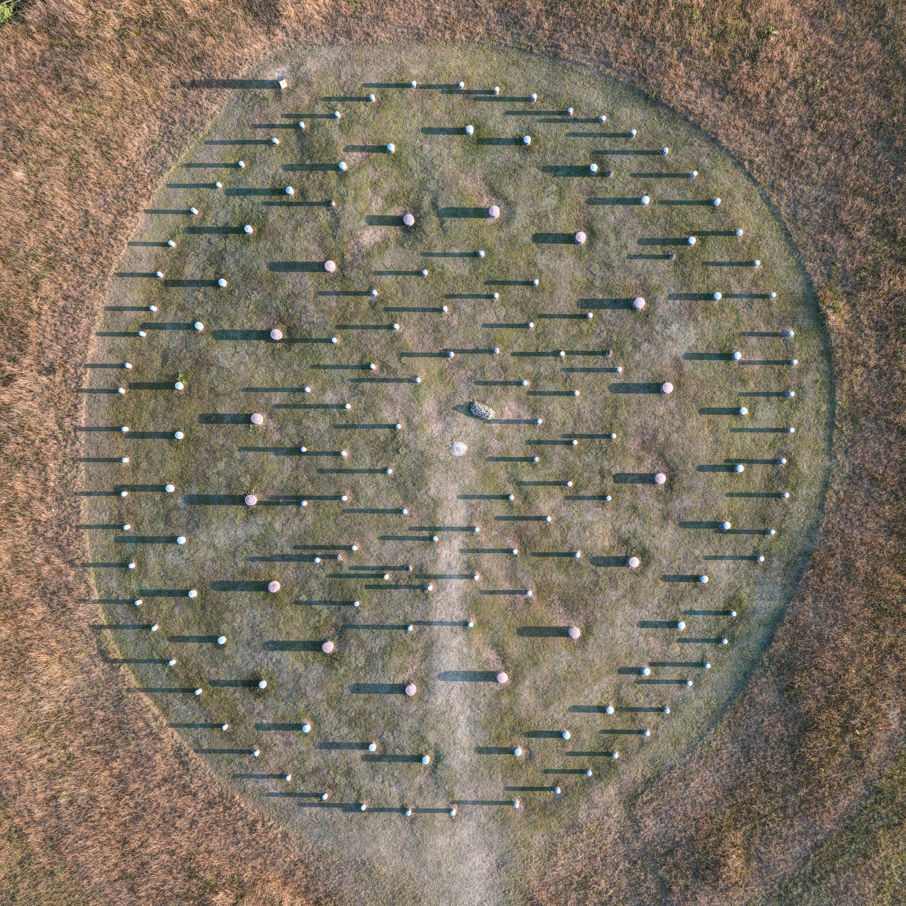
Just after it crests the high ground above Durrington, the path I’m following skirts the site of Woodhenge, a setting of six concentric post circles first discovered in 1925 by Squadron Leader Gilbert Insall, who spotted rings of dark crop marks beside the River Avon while he was overflying the area one summer in his Sopwith Snipe biplane. Insall alerted archaeologists Maud and Ben Cunnington, who spent the following two seasons excavating the site, where they discovered the usual gamut of Late Neolithic depositions (antlers, cattle bones, various flint tools and sherds of Grooved Ware pottery), in addition to three sets of human remains. A pile of flint nodules marks the spot, at the centre of the henge, where the bones were unearthed, while the holes of the 168 timber posts surrounding the grave hold knee-high concrete pillars.
From Woodhenge, you have a grandstand view over the banks of Durrington Walls, a giant oval earthwork erected at the end of the Neolithic on sloping land above the west bank of the river. It’s completely empty today, save for the remnants of an old toll road and a more modern one cut through its eastern segment in 1967. But for a period of around forty to fifty years in the Late Neolithic, this 17 -hectare (42-acre) site held the largest settlement in Europe, with an estimated population of 3,000-4,000 people. The majority were probably transient, staying here over the winter and summer solstices. An enormous amount of detritus – mostly pig and cattle bones – has come to light on the site, suggesting Durrington was the venue for feasting (a theory to which a marked absence of everyday tools - and an abundance of ancient hair and clothing pins - lends weight). People were evidently travelling here to eat, drink and pray, dressed in their Solstice best.
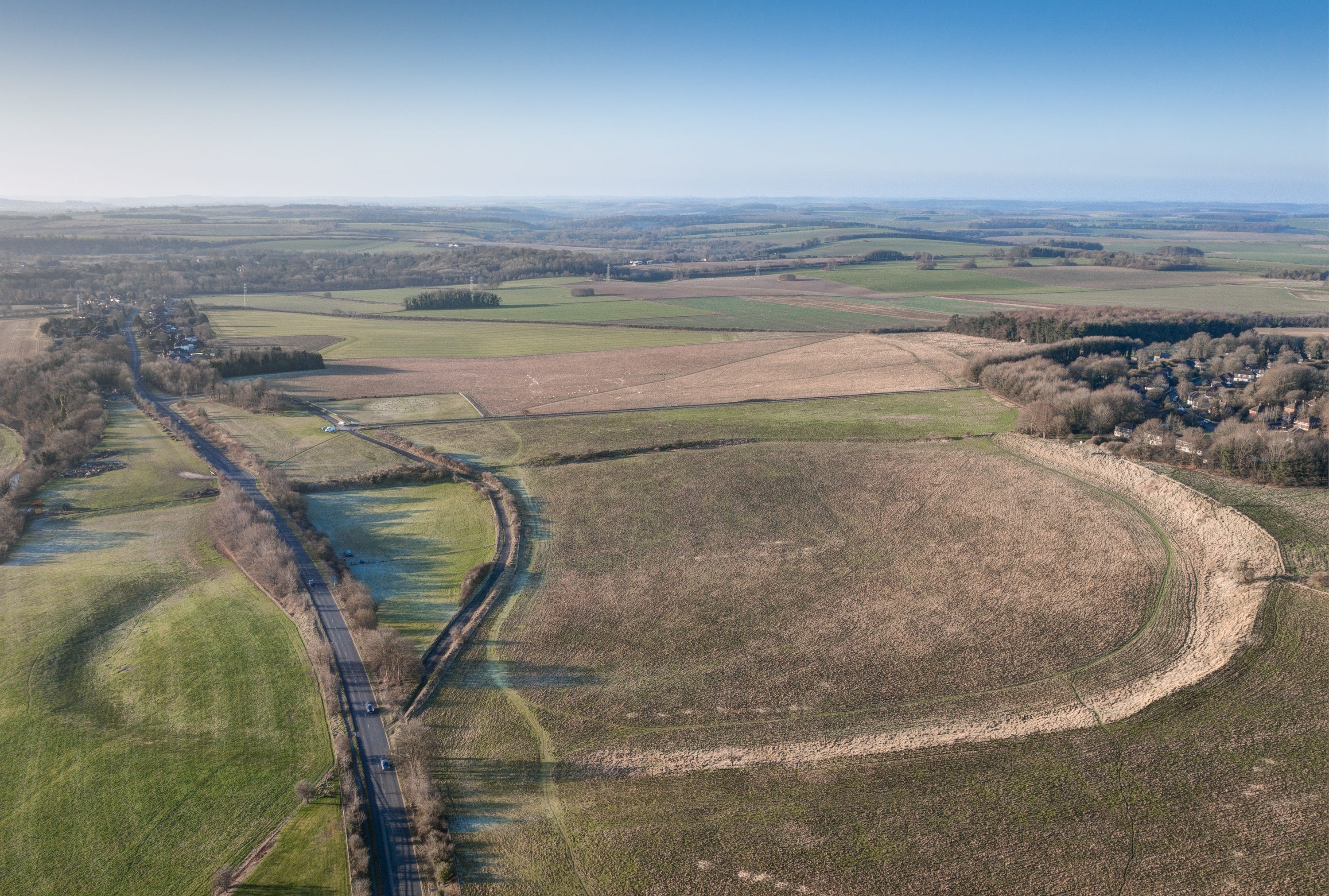
Only around five percent of the total area has been excavated, but geophysical tests have revealed the outlines of around one-thousand structures, most of them small, rectangular huts set around small hearths, along with a handful of much larger houses and halls, like those standing behind the Stonehenge Visitor Centre.
Divided into four distinct quadrants, the central area was dominated by a pair of impressive post circles, similar to Woodhenge. The larger of these, on the south side closest to the river, was enormous, consisting of six concentric rings of wooden uprights, some of them over a metre in diameter. The second ring from the centre formed a horseshoe resembling the giant trilithons of Stonehenge, but unlike its sarsen neighbour, this circle was oriented towards the midwinter sunset rather than midsummer sunrise. Its fourth circuit was the wooden equivalent of Stonehenge’s outer sarsen circle, with the same number of uprights (30), some of which were probably supported lintels. In the words of Mike Parker Pearson, the monument, known as the ‘Southern Circle’, was ‘as architecturally magnificent and complex as Stonehenge itself’.
In 1998, Mike invited a fellow archaeologist from Madagascar to visit Stonehenge with him. A colleague with whom he had previously researched megalithic culture and ritual, Ramilisonina hailed from one of the last communities on earth that still moved big stones around to commemorate their dead. Mike thought he might be able to shed some light on what our Neolithic ancestors may have been up to on Salisbury Plain. As it turned out, his insights surpassed expectations. Ramilisonina understood straight away that the timber circles at Durrington were less likely to be older prototypes for the sarsen and bluestone circles than contemporaries: the flipside side of a single, vast ceremonial dichotomy.
To the east at Durrington lay the ‘Domain of the Living’, with ritual monuments made of perishable wood; and on the other, the ‘Domain of the Ancestors’, carved from imperishable stone. Between the two lay a liminal or transitionary zone, crossed by the River Avon. Could water have connected the two realms, providing a conduit along which visiting pilgrims passed, whether on foot or by water?
The paper Mike and Ramilisonina subsequently wrote about the wood and stone dichotomy caused some debate among academics. Initially it was suggested the theory, while elegant and intriguing, lacked sufficient evidence. So in 2003, a team of eminent archaeologists from across Britain, under the directin of Mike Park Pearson, was assembled to investigate how the ceremonial landscape of Stonehenge may have developed, and, in particular, the relationship between the circles of wood at Durrington and their stone equivalent over the rise. Mike believed the bank-and-ditch-lined chalk Avenue, which approached Stonehenge via its solstitial axis from the dry combe below, might have connected the monument with the river, providing the culmination of a journey – both symbolic and actual – which Neolithic people followed as an act of worship or pilgrimage, perhaps to revere the ancestors or to process the remains of recently deceased loved ones.
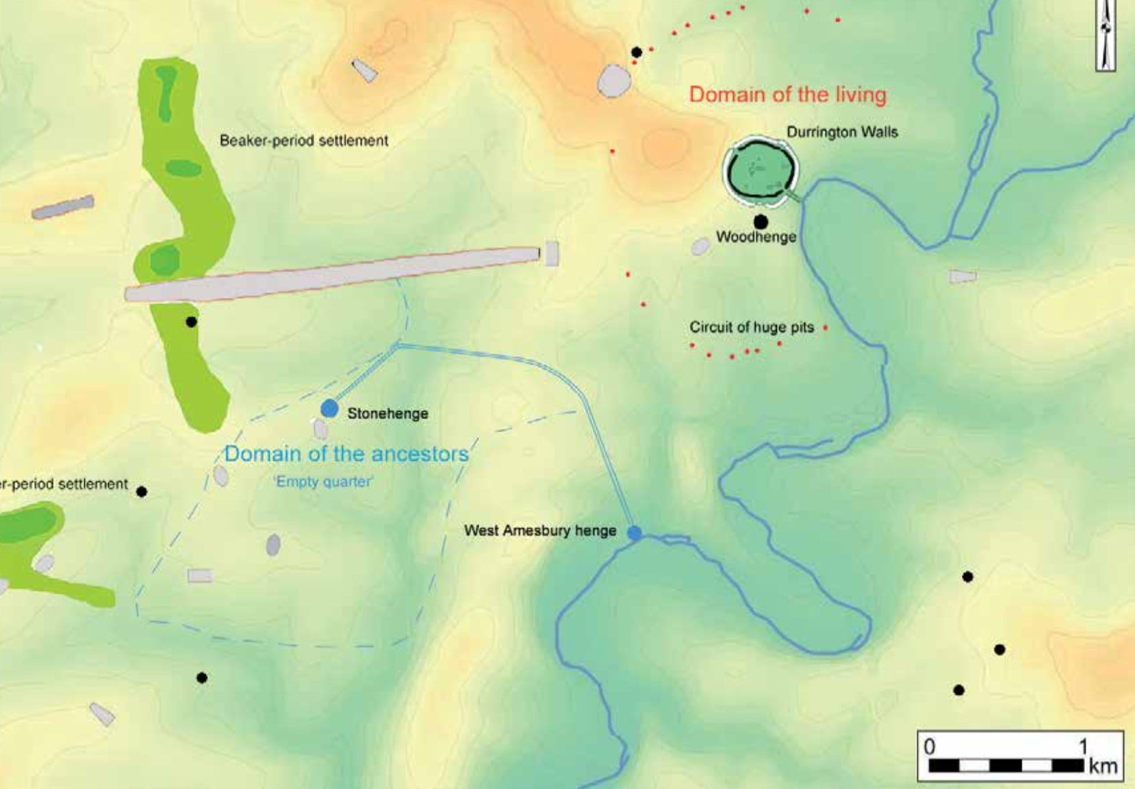
The Stonehenge Riverside Project lasted from 2003 until 2009, during which time a number of notable discoveries were made. Foremost among them was the existence of a flint-paved avenue aligned with the summer solstice sunset, which lead through the great banks on Durrington Walls’ south-eastern bank to the river. At the spot a few miles further downstream where the main Avenue to Stonehenge was believed to begin, the footprint of a long-disappeared henge of bluestones was also unearthed. While falling short of conclusive for some scholars, the wood-and-stone theory has, nearly two decades on, been widely accepted.
From the moment I first encountered it in Mike’s 2012 account of the project, Stonehenge: Exploring the Greatest Stone Age Mystery, I was captivated by the idea that, 5,000 years ago, people converged in great numbers on Salisbury Plain, travelling considerable distances on foot and by boat, possibly from as far afield as the Preselis and Orkney Islands, to attend great feasts and rituals at Durrington Walls, followed by a mass movement through the landscape, via the river, to Stonehenge itself to witness the solstice sunrise or sunset. The idea totally changed my experience of the archaeological sites, which I live near and have visited many times over the years. And yet, for some reason, it took me nearly a decade before I attempted to re-enact the sacred journey itself, from Durrington to Stonehenge via the river.
The catalyst was a short account in Mike’s Stonehenge book of a trip Prof Chris Tilley and colleagues had made by water along the Avon. Aside from sounding like enormous fun, the adventure had taken the team through some highly atmospheric landscape – terrain that’s almost entirely invisible from the adjacent A303. I had driven along that stretch of road countless times, but never seen anything remotely epic out of my car window. On the contrary. The fringes of Amesbury, with its creeping conurbation, giant distribution centres and busy dual carriageways, are about as exotic your average supermarket car park on a drizzly day. I was, however, about to discover that, behind screens of towering trees, highway embankments and modern buildings, lies a parallel world retaining much of the wonder that inspired the Neolithic herder-farmers of Salisbury Plain when they discovered it six-thousand years ago.
Here then is a picture essay showing images culled from three trips along the river I’ve made this summer. It hasn’t been an easy journey, as you’ll see - much of the Avon is inaccessible these days, running through private land protected by private security firms – but the experience has, nevertheless, been revelatory. As I write, I’m planning to do the whole thing in one go by canoe, which is how, I have concluded, people in the Neolithic must have made the journey. The final stage would be to do it at night, and to walk the final stretch on foot up Lake Bottom to the stones in time for sunrise – though that may throw up many logistical and legal problems!
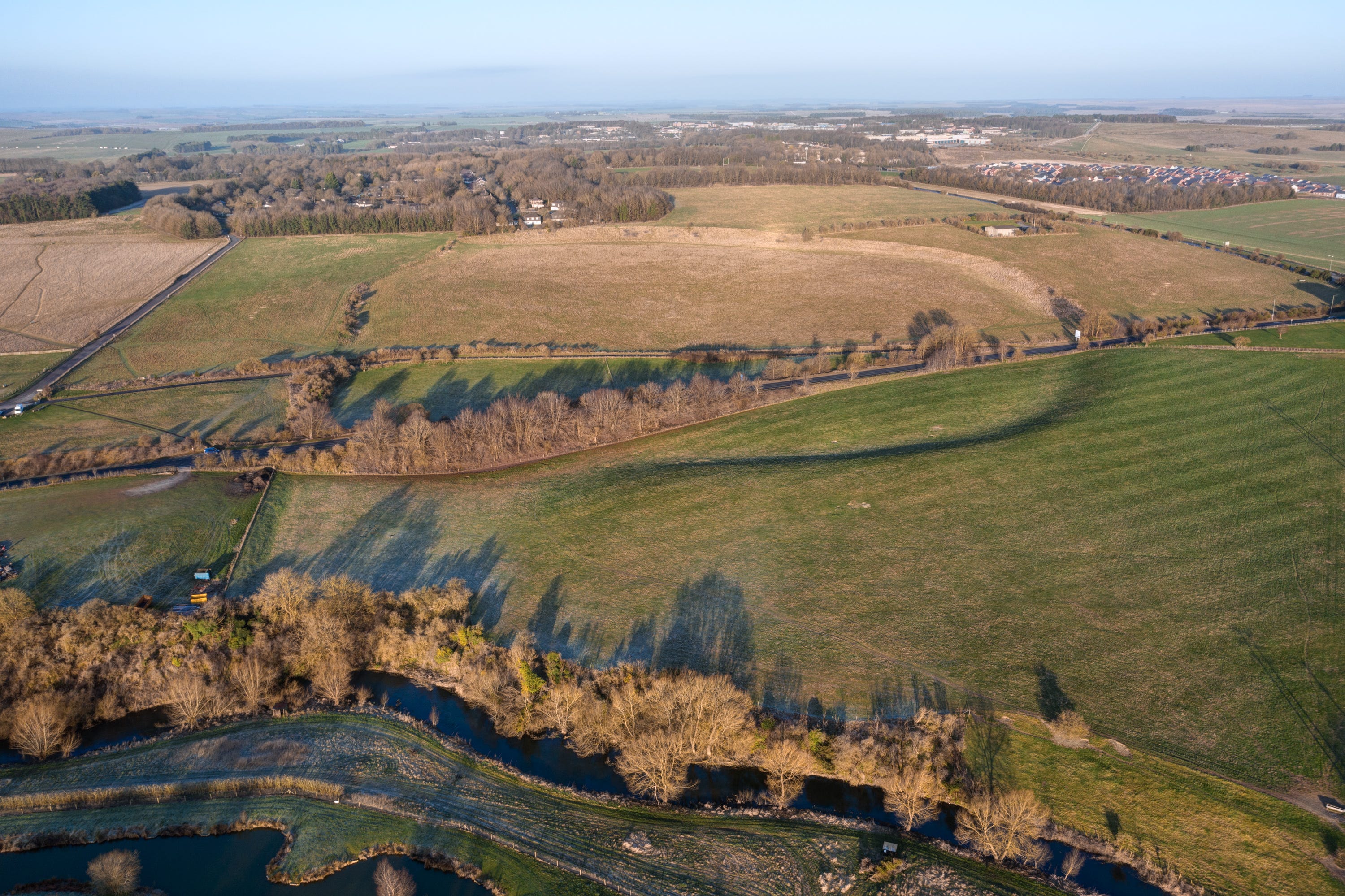
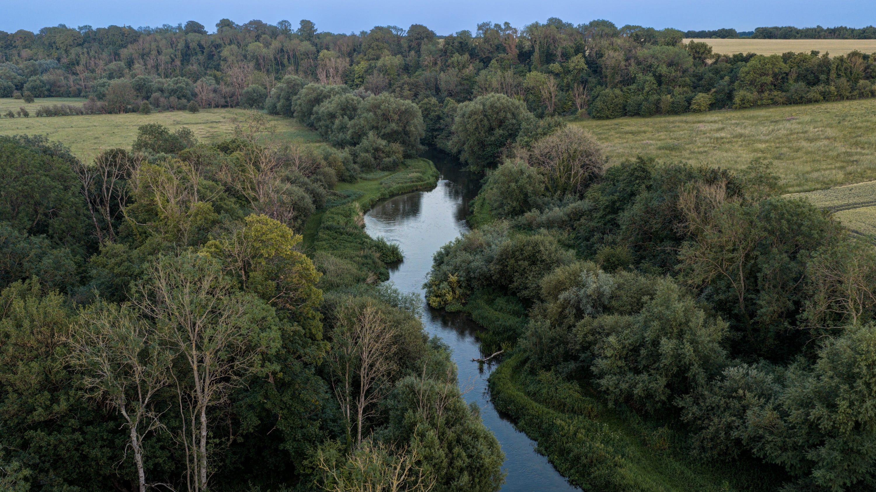
Durrington Walls from the east side of the River Avon. Paved with broken flint and sarsen rubble, with banks and ditches on either side, a 15-metre-wide Neolithic ceremonial avenue led from the settlement to the river, marking the start of the pilgrimage route. It is now invisible above ground, but would have crossed the blue and yellow farm fixtures bottom left of image. The river itself follows almost exactly the same course at this point.

A series of dramatic meanders occur south of Durrington, where the river is edged by giant river cliffs. In the Neolithic, the tops of these were cleared of trees at some sites, where structures made of four huge timber posts rose from the cliff edges. These are thought to have have been excarnation platforms. The pits that were left after the timbers rotted were later used for ritual depositions (including of bear bones, weirdly). They are now buried under residential gardens on Countess Road and Ratfyn Road in Amesbury.
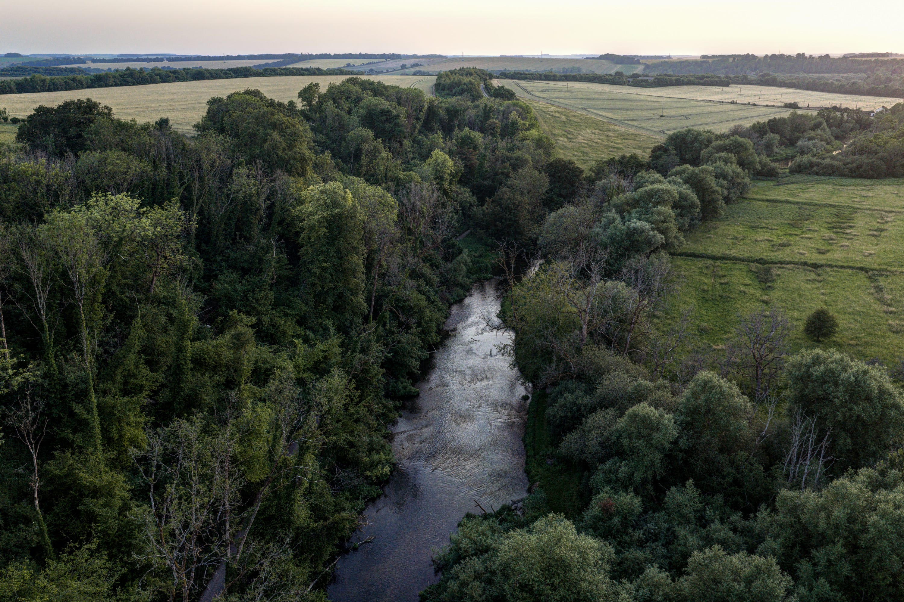
Here the Avon arcs into the penultimate great meander as it bends towards West Amesbury. This is one of the few stretches you can legally follow on foot, via a public right of way. Further south, a series of large estates and grand houses prevent access. Private security firms are employed by some to enforce fishing rights.
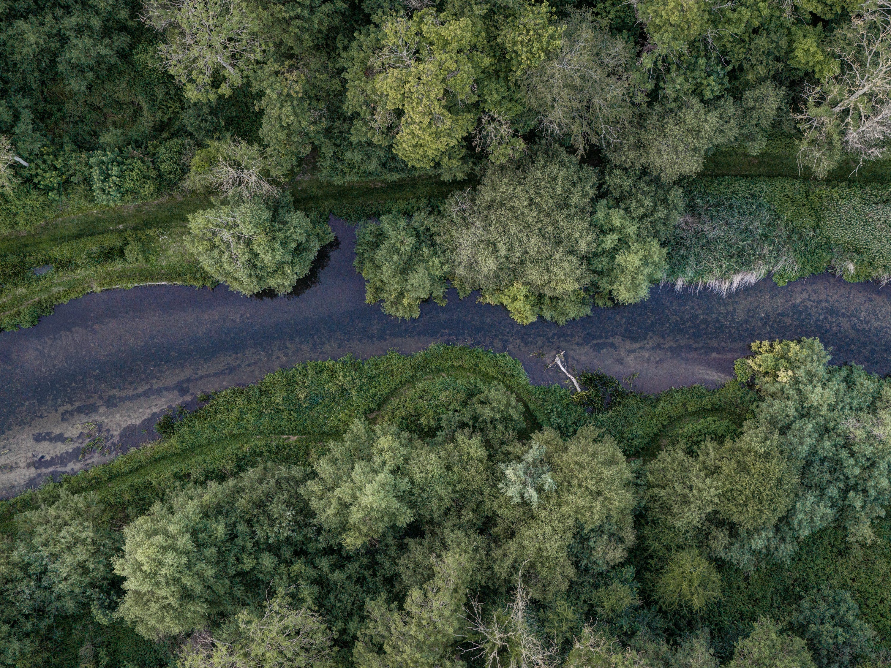
Despite being polluted by outflows from a couple of large sewerage treatment plants upstream, the gin-clear waters of the Wiltshire Avon remain clear and sparkling. It’s easy too see why our ancestors might have venerated this waterway, which flows from the Vale of Pewsey to Salisbury, and thence south to Christchurch Harbour. It would, 5,000 years ago, have provided the region’s principal travel artery and access to the open sea for inhabitants of the Chalklands.
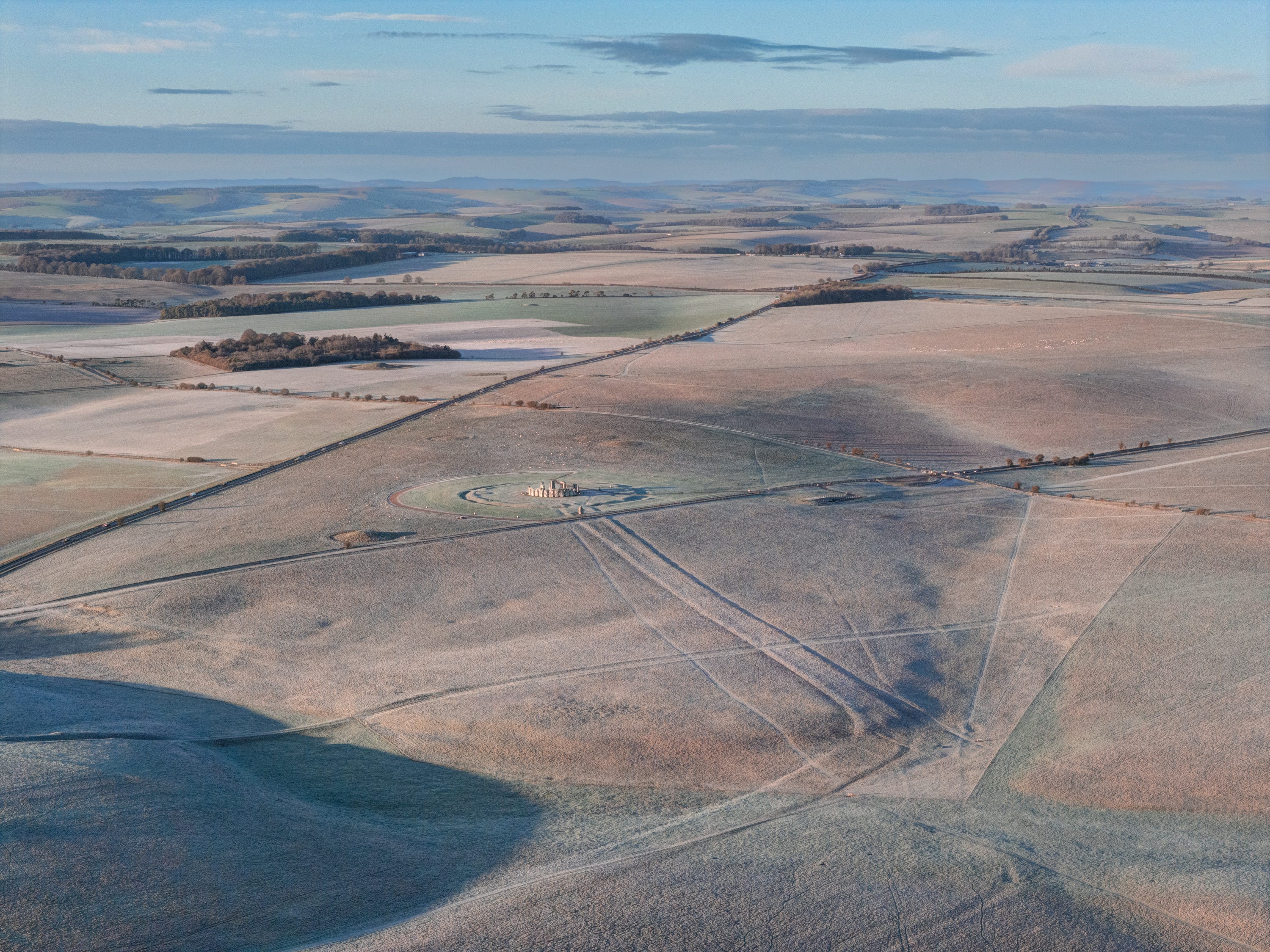
Towards the very end of the Neolithic (around 2,300B, a couple of centuries after the sarsen trilithons and circle were erected), a ceremonial trackway was built from the Avon to Stonehenge. This photo shows the point where, after crossing the Kings’ Barrows ridge, it drops down into Stonehenge Bottom, a dry combe, before swinging in southwesterly direction, along the axis of the midsummer sunrise/midwinter sunset solstices. Flanked by ditches and banks, the Avenue was capped with a surface of gleaming white chalk and would have been highly conspicuous.
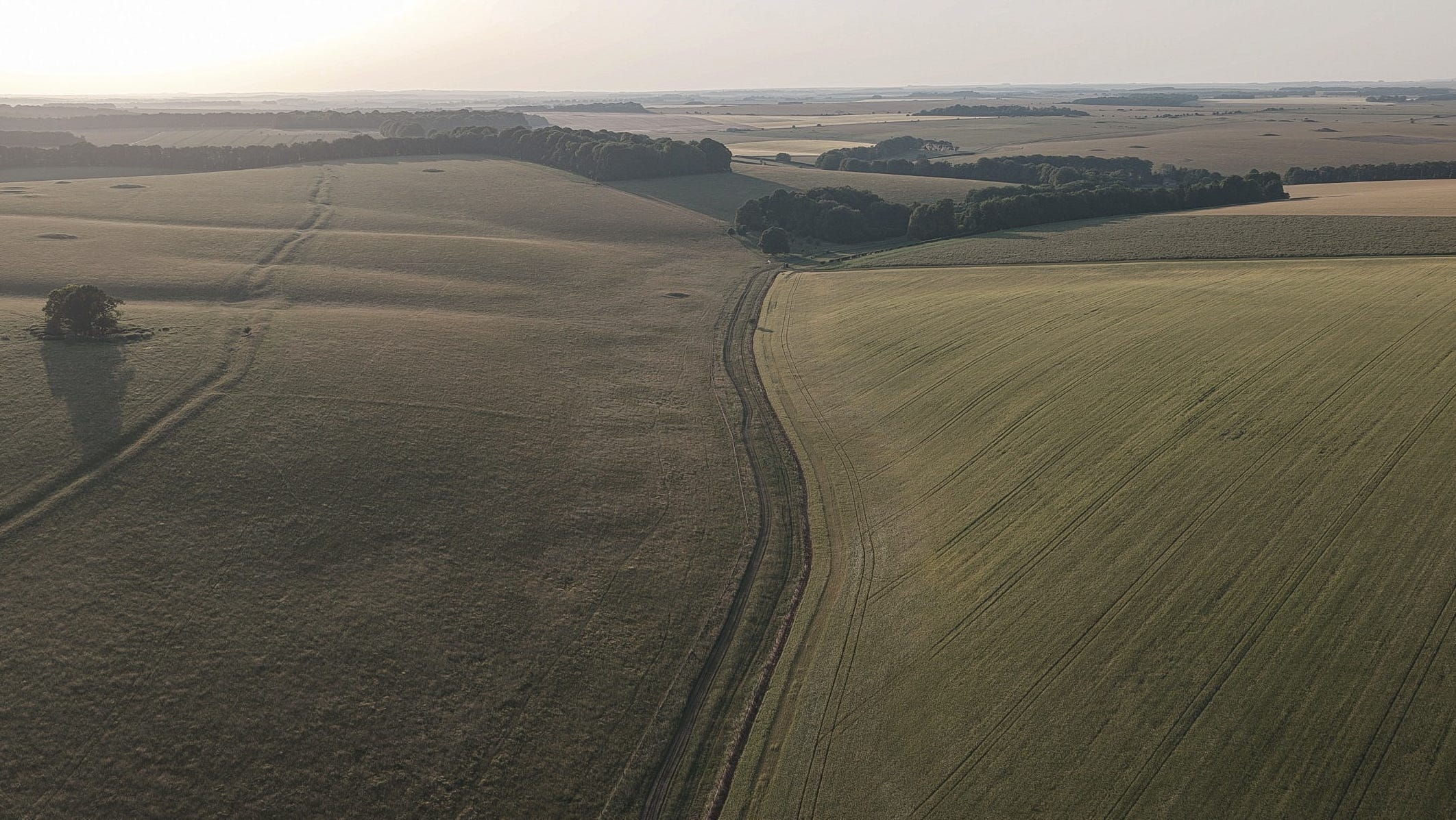
Prior to 2,300BC, for possibly as long as a ceremonial earthwork existed at the site of Stonehenge, the route most likely followed by Neolithic pilgrims from the Avon followed the course of a spectacular dry combe. Its mouth is a the village of Lake. Following it today, the atmosphere is dominated by dozens of atmospheric Bronze Age burial mounds on the floor of the valley, and overlooking it from the surrounding hillcreses.
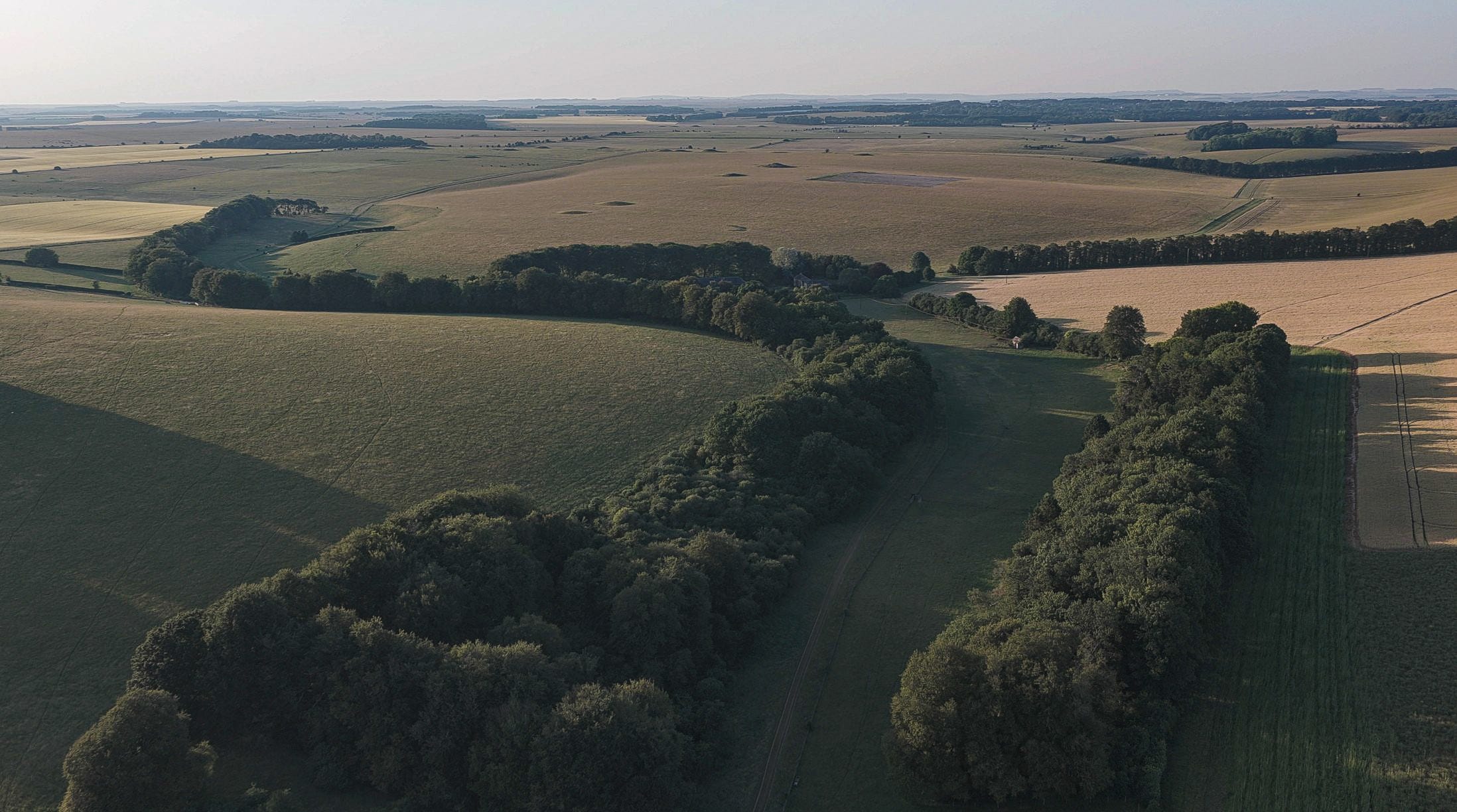
Halfway up the valley, the combe bifurcates, with one branch leading left (west) over Normanton Down and the other, Stonehenge Bottom, continuing due north to the stone circle (and A303). The latter is not a public right of way, but you can follow a clearly marked bridleway over Normanton Down, which takes you right through the middle of the great Bronze Age necropolis overlooking the stone circle from the south. Among the largest mounds is the Bush Barrow, which has yielded some of the finest grave goods ever unearthed from Bronze Age Britain.
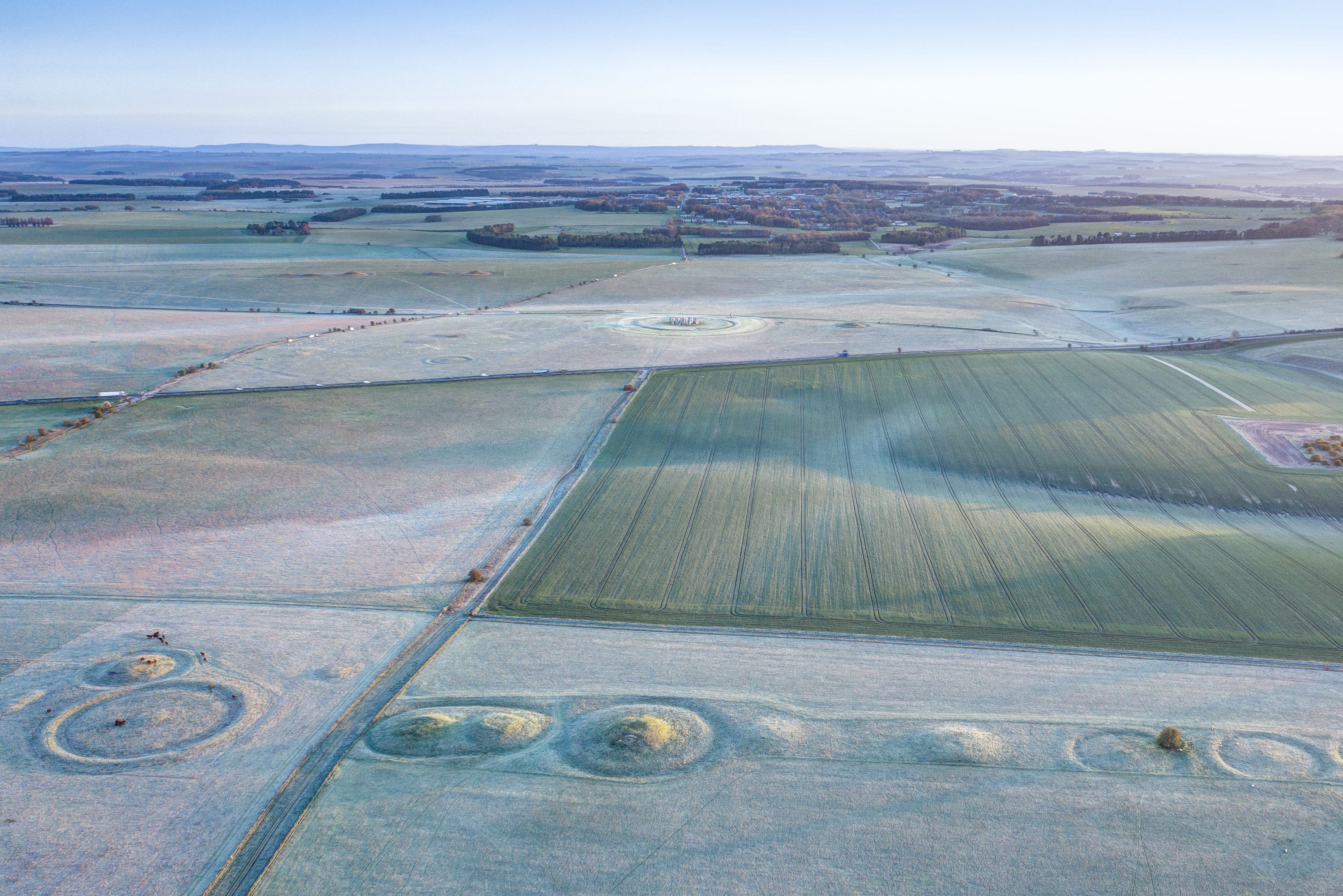
The Normanton Drove, cutting through the barrow cemetery, with Stonehenge visible in the distance. The Neolithic ceremonial route to the stones would probably have followed Stonehenge Bottom, which you can see top right, from which pilgrims would have approached the monument from the northeast, via its solstitial alignment.
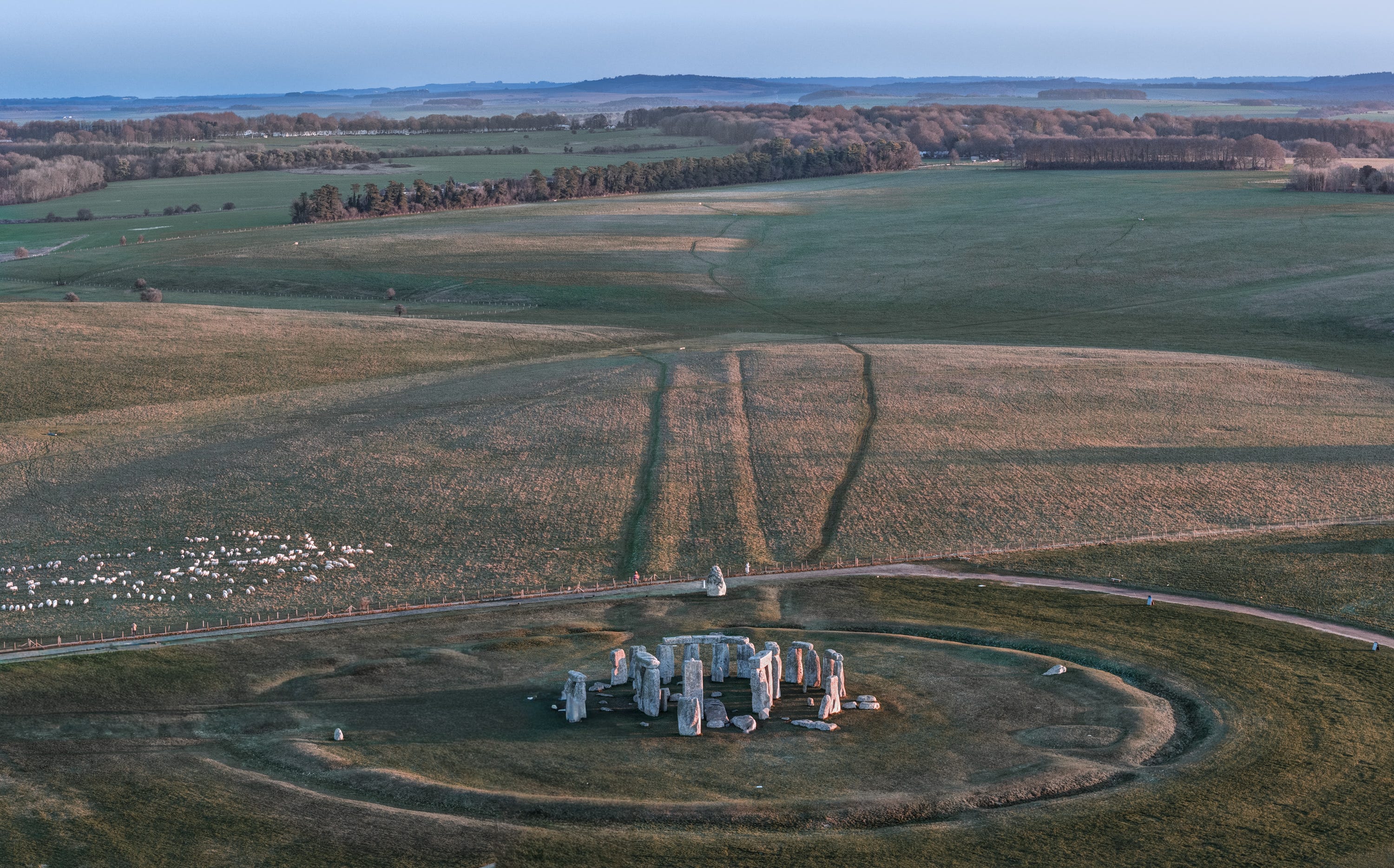
The final stretch of the Avenue as it arrives at the Heel Stone, having climbed out of Stonehenge Bottom (to rear of image). The slope would have masked the trilithons, revealing them gradually - and to spectacular effect - as pilgrims ascended.
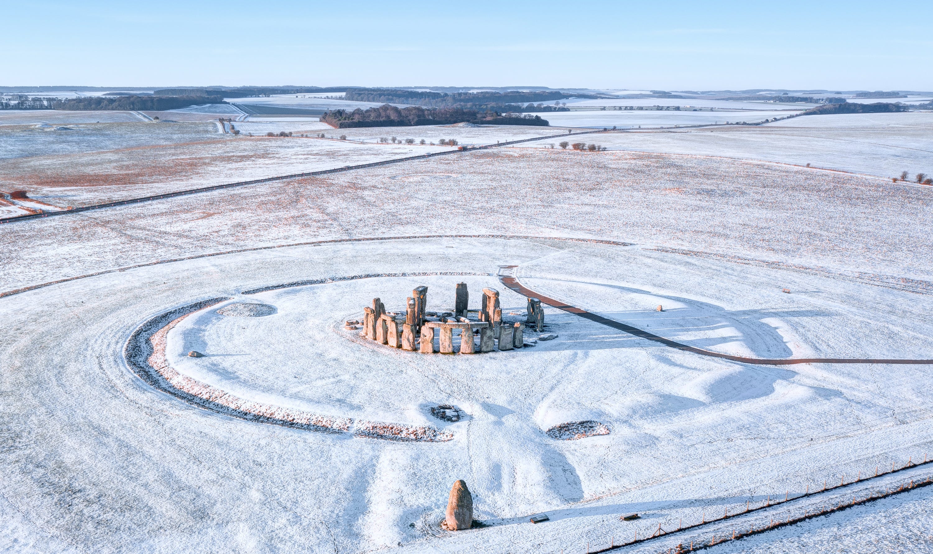
The great trilithon ‘horseshoe’, looking southwest along the solstitial axis over Normanton Down - culmination of the ‘pilgrimage’ from the ‘Domain of the Living’ to the ‘Domain of the Ancestors’.
Thank you!
Thanks for reading this article. If you enjoyed it, please give it a like and do share with friends of family members you think might be interested.
I’ll be writing about the River Avon, and my journeys along it, in more depth in my next book. In the meantime, you can follow me on Instagram (@davidrabram) for more of my work.
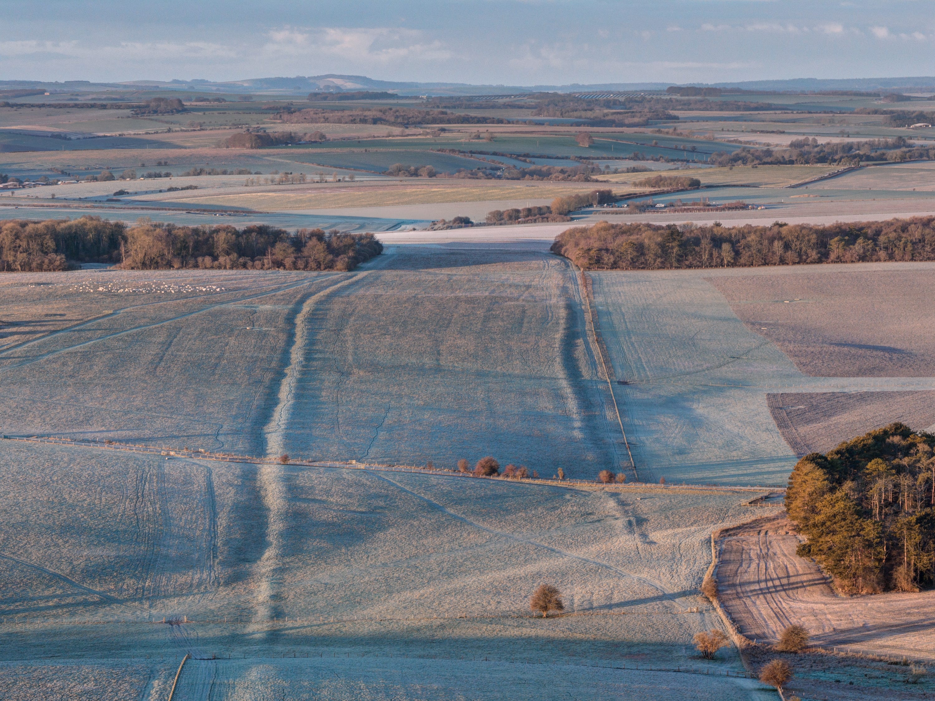
One final image: the Great Stonehenge Cursus, dug at least two or three centuries before the original ditch and bank was cut at Stonehenge itself. The earthwork is crossed by the same dry combe/winterbourne I followed from the River Avon at Lake. These ghost or spirit rivers, which Neolithic people may have interpreted as the work of the ancestors, must have been a big part of the area’s appeal (as it is for me today). Just a shame the culminating part of Stonehenge Bottom is on private land with no Right of Way. Grrrr.
Thank you David. Having grown up just south of Salisbury, with Stonehenge and the Plain a bedrock of our experience I loved reading this. I feel angry too that in this modern era, we are deprived the same experience and access by private landowners. These ancient routes should be public rights of way: when I am Empress of the World, which can only be a matter of days away, I will make it so. As per my school moto (SWGS Salisbury) “ONWARDS!”
David, when you "re-enact the sacred journey itself, from Durrington to Stonehenge via the river", presumably by canoe, how about taking a GoPro & posting the video ? That would be amazing !